September 7, 2010

Snoqualmie Pass Overnight, July 6-7 2010

I had some work in Seattle in July, and in order to both save money and make best use of good summer weather, I thought I'd go camping on my one free night, instead of staying in a hotel.  I got out of rehearsal around lunchtime, then hurried out I-90 to Snoqualmie Pass, the lowest pass in the Cascades (with the obvious exception of the Columbia River Gorge, which isn't your normal pass, anyway).  I wanted to visit a spectacular area I'd seen the summer before.  That didn't turn out, but I still had a pleasant night out.

At the trailhead, there were notices that snow covered the area, just uphill from the trailhead.  At this point, I decided to give a go at it anyway, and not worry about reaching my destination.  Instead, I'd just walk up as far as practical, and take photos of whatever presented itself.

The trail started out like normal:


Soon, though, I was running into large patches of ice-crusted snow.  I detoured from the main route to a viewpoint of Source Lake, which is the source of South Fork Snoqualmie River.  


Working my way up from there required rough route finding and lots of decision making.  Walking on this slippery snow can be dangerous- a slip and fall can be painful, and falling on a steep slope with a bad landing can break bones.  These are an example of the cognitive challenges for which I've named this blog.  Every hundred feet or so calls for a routefinding decision.  The variables are snow quality and depth, angle of slope, the "run-out" or area beneath the slope, presence or absence of trees (they can stop a fall, but their presence means that there are possibly unstable snow bridges built over downed logs- if you step on one, you can suddenly plunge in several feet to the ground beneath; never pleasant, and sometimes bruising!), and above all, remaining oriented and picking an efficient path to your goal.  

I've never had much trouble staying oriented here in the Cascades- since I always have a good map, I can read the contours of the land, and compare with what I'm seeing.  It's different in flatter places, and different in heavily wooded canyons.  If I was traveling in Maine woods, or probably even the Smokies, I'd have much less confidence.  

I've only been mis-oriented once, with a friend.  We were looking for a road under many feet of snow, and somehow managed to pass over it twice before ending up pointed in exactly the wrong direction.  We recognized some familiar landmarks that were in exactly the wrong place, and got out the compass, which naturally pointed up back in the right direction.  It was a humbling and also sort of exciting experience.  I enjoyed using my brain to find myself.  

I had to meet back up with the main trail by following a big ridge over about half a mile or so.  I walked up the safest route I could, and took my time.  Kicking steps into the snow takes energy and time.  I should point out that this kind of travel isn't really all that big a deal- it's not mountaineering, and it's the way a lot of people hike in the winter and spring, up here in these northern places.


Looking up the ridge:


I walked over the top of the ridge and viewed Snow Lake, which I had walked past almost a year ago, in beautiful summer weather. . . and not a flake of snow anywhere.  The late spring was a big disappointment.


Once at the top of the ridge, I could also see off the other side, back to the Alpental Village, which is a ski resort community down in the valley:


I scouted out a few places to catch morning sunrise light, and settled in for the night.  I managed to find a tiny sliver of dry ground.  I know it's okay to sleep on snow, and I hear that it's not all that bad.  But I have a philosophical aversion to camping on snow in mid July.  I just think it's wrong to have to do it, so I took the time to find a nice soft spot of real dirt!  


The next morning, I got up way too early (should have checked the weather to see when the sun rose).  So I waited in my photo spot for 20 or so minutes.  Sitting on a sleeping pad on snow, waiting for the sun to rise.  


I was rewarded when the sun came up, but couldn't find a really cool vantage point to exploit the light.  Compared to the last trip out here, this was a bust.  But it was still a pleasant bust.  All photos are of Chair Peak, I'm pretty sure.    


I walked down out of the mountains, and was at the car by about 8 am.  I was back in Seattle for rehearsal at about 11am, after having a nice hot breakfast in a restaurant at the Pass.  That's frontcountry hiking for ya!
Hope you enjoyed.


September 2, 2010

Ninemile Ridge Overnighter; June 2010

After fulfilling my pedagogical duties in Wallowa Lake, I hustled (as fast as one can hustle on miserable backcountry Forest Service roads that are not even graveled) back over to the North Fork Umatilla Wilderness.  I'd camped there on the way out, and planned on walking another short route on the way back  to Portland.  I arrived a little late (as always) and hurried up the trail.  I had to carry about two liters of water, as this ridge walk passed no springs or flowing water.

Lorain wrote that this ridge has one of the best flower displays in the state.  Starting out, I walked up slopes with scattered ponderosa.


Along the way, I spotted this lizard, eyeing me nervously:


Finally, I reached higher ground and started to get some views up the ridge:


Switchbacks up the side of the ridge had me walking into the sun:


At this side spur of the ridge, there is a small colony of a rare variety of sagebrush, the only sagebrush I saw in the area:


As well as this probably un-rare grass:


Ridge walking is my favorite sport.  Valleys are pleasant for camping, and mountains pleasant for a high viewpoint, but walking a ridge provides ever expanding and ever changing views of sights both up close and far away.  Ridges have a more human scale and more accessible photographic variety than mountaintops, while often allowing the same access to beautiful evening light that is lost in many valleys and canyons.  Having gained the ridgeline, I could see off into both canyons, as well as the top of the ridge.


As the sun set, I stood in a rocky meadow with great wildflowers- here there are indian paintbrush, clarkia, desert parsley, and a little bit of that sagebrush.


Walking up after sunset, I noticed quite a bit of what looked like sign of a bear- the trailside was dug up and dirt was spread downhill.  I know that they like to vigorously dig up routes, and also that they like to follow a trail just like people do (given that no one is around to bother them).  And still great views and light and flowers.  Here are some yellow lupine:


My navigational goal that night was a high point on the ridge, a cairn on the ridge at 4,568 feet.  Upon reaching the cairn, I used its height over the grass to set up my mini tripod to take photos of the distant light.  To my great and everlasting surprise, I discovered that I could see clear to Mt. Adams and Mt. Rainier, in Washington.  The horizontal distance to Mt. Rainier is 189 miles.  I've never seen that far in my life, and it's only possible because of the great relief of those mountains and the clear air of this dry, unpopulated (unpolluted) place.  Otherwise, they'd be lost in haze.  Mt. Adams is on the left, Mt. Rainier on the right.


I wondered, after this, what the true limit would be; I wondered how far one could possibly be from Mt. Rainier, and still see it.  I still can't quite believe it.

I made camp, stretched out, and observed the moon coming up across the canyon of Buck Creek.  This is a handheld photo at a high ISO, and even though it's not technically adequate in a fine art landscape idiom, I think it does say something interesting:


I didn't bother to set up a tarp, and enjoyed seeing the moonlight bathe the ridge.  Remembering the bear sign earlier, I strung up my bear bag on a scraggly alpine tree.  Though I always string up a bear bag, sometimes the devil in me says "I'm too tired, and I don't feel like getting up out of the bag to do that."  The self-preserving part of me wins out, imagining a midnight visit by a curious bear that happens to share my love of chocolate bars and couscous.

I woke up at about 5 a.m. and saw the moon setting, just as the sun was rising and turning floating particles in the sky a nice purple.


From my vantage point at the cairn, I also spotted the bear that had been digging up the hillside in search of nice bulbs and roots:


This juvenile wasn't interested in me, though it certainly knew I had spent the night there.  The nose of a bear is more powerful even than a bloodhound's, and cooking dinner would have immediately tipped it off.  When I stood up and started taking photos of it, though, it got a little wary, and ambled down the hill to the trees.

I walked over the ridge a little, taking in the sights.  Here's a field of wild onion:


Here they are close up:


I walked back to the cairn, where light was beginning to hit the lupines:


I also saw the bear again, as it had gotten back to its feeding on the open slopes:


Walking back down the ridge in fields of purple and blue lupine:


Here's an up close view of one flower that might be unfamiliar to my folks back east- Clarkia, named after Captain Clark, Lewis's friend and co-explorer.


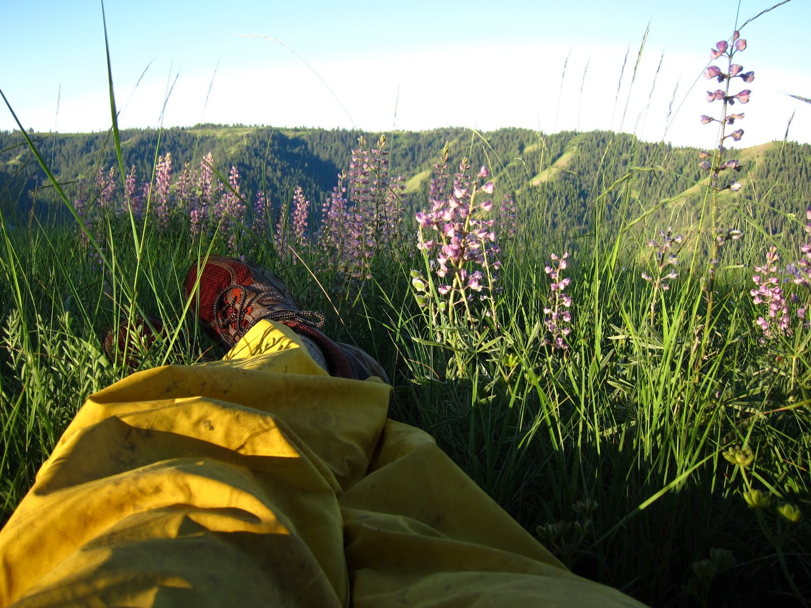
Heaven on earth?  One of many such places I've found.  Time to kick up the feet, lean back on a small tree, and enjoy life:


Thanks for reading!

August 28, 2010

Wallowa Lake, and day trips

While I was at Brass Camp, I didn't have much time to do anything but teach and eat and try to sleep.  I think the sleeping was the hardest- the sun was up before 6 each morning, and it took me several days to realize that it was coming right through the window and waking me up.  Some heavy blankets solved that problem.

This selection of photos is fairly random.  Most were made at less than ideal times of day, and none were made in real wild areas, which are my usual habits.  The light on the lake was often confounding: though it's very scenic, the mountain that backdrop the lake get no sunset light at this time of year, and the area on the other side of the lake is a small town.  So, while I did see some amazing light, the nearby scenery wasn't helpful:


That's the best light, but there wasn't any way to get a no-clutter photo of it.  Oh well, this one was pretty nice, with an assist from the moon:


I did manage to take a few trips.  One, on my mountain bike, was to ride out of camp and down the road to Joseph for about a mile.  Then, after crawling under a fence, I'd enter a local rancher's property.  He has placed the land under some kind of conservation easement, and allows folks to visit.  Cattle are still grazing here, though, and avoiding cow patties was the main technical difficulty on the ride.  The main difficulty was aerobic: climbing the absurdly steep road at this high (for me) elevation.  It was burning lungs time.  Great fun!


The rewards are obvious:


They call this whole area around the Wallowas the "Oregon Alps" or "Little Switzerland".  With all due respects to the community in North Carolina that calls itself the same, I think the Wallowas fit the bill more perfectly.  It's not just the impressive vertical relief of the mountains, but the fact that they are surrounded by miles of lush green pasture and farm land.  It's certainly not the politics!

The road goes to the top of what's called The Moraine, a giant ridge of material dumped by the continuous movement of the glacier that created the lake thousands of year ago.  At the top of the ridge, the road heads up to the trees of the Wallowa Whitman National Forest:


I didn't have time for that (had to get back to teaching trombone!) so I turned back around and explored a tiny bit down the pasture, where I found a typically amazing bucolic scene, complete with cows:


After screaming down the road (and scaring one poor cow out of her wits!) I stopped to look at the lake close up:


One of the evenings we had a social event in Joseph, the small town nearby.  Afterwards I took a while photographing downtown under moonlight:


One of the days, I took a friend hiking.  This friend has some notorious bad luck with outdoor adventures.  I thought maybe we could take a short easy trip, so he could see how nice it can be withouth getting lost.  Sure enough, we reached a creek that, according to my guidebook, would be a shallow ford.  Not so.  It was swollen from much recent rain.  I stepped in with my trekking poles to check it out.  The water raged over very slick rocks with moss growth.  20 feet downstream was a precipitous waterfall.  It was a bad scene!


I probably could have done it, and might have done it myself, but being in a group can make me cautious (that's probably backwards, I know, but since I hike so much, I feel more responsible for anyone hiking with me than I feel for myself).  We turned back around and found a boot path heading back down our way.  We couldn't find any other way over the water, and were bushwacking over steep slopes in heavy brush in no time.  I swear I just wanted to take him on an easy 2.5 mile hike!  We got out (through someone's backyard accidentally), and I promised my friend that that kind of thing doesn't normally happen to me when I hike.  Maybe his bad luck rubbed off on me.

Anyway.  By the end of the week, I was still trying to get that calendar shot of Wallowa Lake.  I had some close ones:


Now this one was real close, but that guy in the boat never drifted out of the picture.  Just kept making exasperating circles!


Since I felt that I hadn't quite gotten what I wanted with sunlight, I took one last photo of the lake.  Using the flash and an centered framing isn't my main mode, so it turned out rather different:


Hope you enjoyed reading!

August 21, 2010

Wallowa Lake Trip, Day 2 and 3, N. Fork Umatilla River

Arriving in the evening, I walked out from my car into a dark and densely forested canyon.  As I walked, I was wetted by the bushes encroaching on the badly overgrown trail.  Since the trail is in a congressionally designated Wilderness area, some trail maintenance techniques and machines are not allowed.  Falling back on older, more traditional methods takes more labor hours, and is thus prohibitively expensive.

As a result, the Forest Service maintains important wilderness trails less frequently, and unimportant ones very little.  Some trails eventually disappear into the forest.  Some local hikers in the Portland area make great sport of finding and hiking the abandoned trails.  For them it is a detective game involving old maps, first hand accounts of elderly explorers, and Forest Service records.  They can often find old blazes on trees, disappearing bench cuts on traversing terrain, and the occasional lost bridge or rockwork.  At any rate, I was just getting wet, and wished that someone would have come in during the spring and brushed out the trail.

I found a lovely campsite (flat, dryish ground in spite of the day's rain).

I walked on up the canyon the next morning.  I found that, after a certain point, the trail had been brushed out!  I was curious why this portion had been cleared, but the first miles had not.  As I walked along, I passed over some horse droppings right on the trail.  It's more common on the East side of the state to see horses, because a lot of travelers prefer horsepacking.  So I didn't think too much of it.

I came to a large campsite, with several very dirty men standing around a smokey fire.  I waved.  After greetings, they asked me if they'd seen any mules back down the trail.  The mules had escaped in the night during a storm (I slept straight through it apparently).  I told them about the droppings, but they had guessed that the horses headed up hill to a big meadow.

Turns out that they are a maintenance crew working on clearing out the trail.  They're contractors, not Forest Service employees.  Aside: the Federal Goverment doesn't do anything anymore, just pays for-profit companies to do things for it.  They said they'd been out for about a month, and would be out for about another two.  They looked like it, too.  They were standing there in a fine drizzle, wearing cotton hoodies and jeans.  I asked them if they ever get dry.  They claimed that if they can keep their sleeping bag dry, it's not too bad.  Seems like misery to me!  Later on, I got to look at their site while they were gone:


The younger guys slept in a tent (smelly, yathink?) while the older gent, possibly wiser, slept out under this generous tarp.  That's his bag on the green sleeping pad.  I was very surprised to see all of their stores of food sitting out on the ground.  Sure, there are bears occasionally, and that's a great reason to hang a bear bag.  But, think also about the ground squirrels that seem to live in every tree in the woods.  They'll steal anything that's not too big or tied down.  I can't believe it's possible to get away with this!

Anyway, back to the hiking:

The trail turned hard to the left and headed up an open meadow, with increasing views.  


I walked along and very soon came upon the mules.  They didn't look happy to see me, and ran up the trail ahead of me.  I shouted down to the camp, and waited to see if the guys would come up to take the animals.  Nobody came up, so I headed up.  

The trail work had made the trail picture perfect in its grade and dimensions, but the wet weather (this spring will live on in infamy, I'm sure) had turned the trail into a mucky mess:


The views were pleasant.  Here's an old Ponderosa with a young fir.  I think.  They all look alike.


Views increasing, in spite of fog that never lifted:


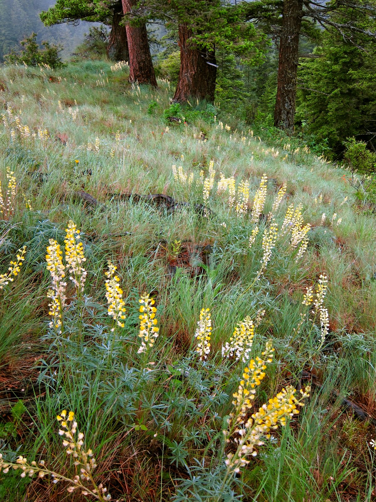
Here I discovered a lovely field of yellow lupine, which I'd never seen before:


Another view:


Hope you enjoyed!