I took a two night trip back in October. I had one and a half days off, so I planned a "pack it in" kind of trip up on Mt Hood, with the main goal being a difficult 19 mile backpack trip up to a high point on Yocum Ridge.
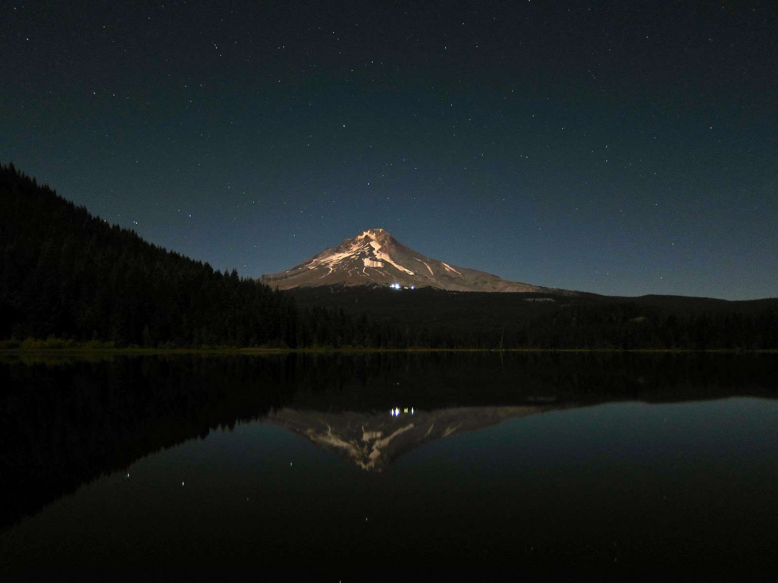
I left Portland after teaching on a Tuesday evening (around 10 pm), and spent the night in my car at Trillium Lake, south of Mt Hood. I arrived a little before 12 midnight, and decided to take a few photos in the great moonlight from a nearly full moon. It directly lit the south side of the mountain.
The next morning, I woke about 6 a.m., shook the cobwebs out, and walked along the dam creating Trillium Lake. I wasn't alone. This spot is definitely
out among photographers. I saw about 3 other tripods out there. There was also a cold looking angler trying his luck.
The big attraction is of course Mt Hood.
There were also aspens turning yellow. I prefer the black and white version, myself.
After waiting around a while, I drove on to the trailhead to access Yocum Ridge. The route begins at a very busy trailhead with access to Ramona Falls, the PCT, and lots of mushrooms. The area is called Old Maid Flat, and is a plain of jumbled lava flows overgrown by trees and vast carpets of lichen and moss. It's a pretty area, even for this region. There were cars parked everywhere along the roads leading in. I initially wondered why all these people had camped out along the road the night before, but realized soon thereafter that most of these people were out hunting mushrooms. I saw several myself.
I walked up toward Ramona Falls through good fall colors on the maples. This part of the route was relatively crowded, but since it was a weekday, it wasn't too bad.
I've noticed that maples in the rocky, sunny areas turn a vibrant red or orange, while the ones under evergreen canopy usually turn sort of sickly yellow. This band of trees is rooted under a spectacular set of basalt cliffs. I nicknamed this the Yosemite of Mt Hood!
When I arrived at Ramona Falls, the sun was low in the sky (it's always more or less low at this time of year), and thus setting off a nice little rainbow in the falling water.
I left other hikers behind after the falls, and headed up Yocum Ridge itself. Beyond here I saw no one else during my trip. I continued to pass nice color, as well as a few giant trees, including this Doug Fir on the left.
Farther up the ridge, the trail passes a tiny, shallow lake with a campsite hidden in trees. Here I managed to get a little dirty water. It's harder to get water from a lake, especially one so shallow. I needn't have bothered, actually, because I passed a very nice stream about half a mile farther up the trail.
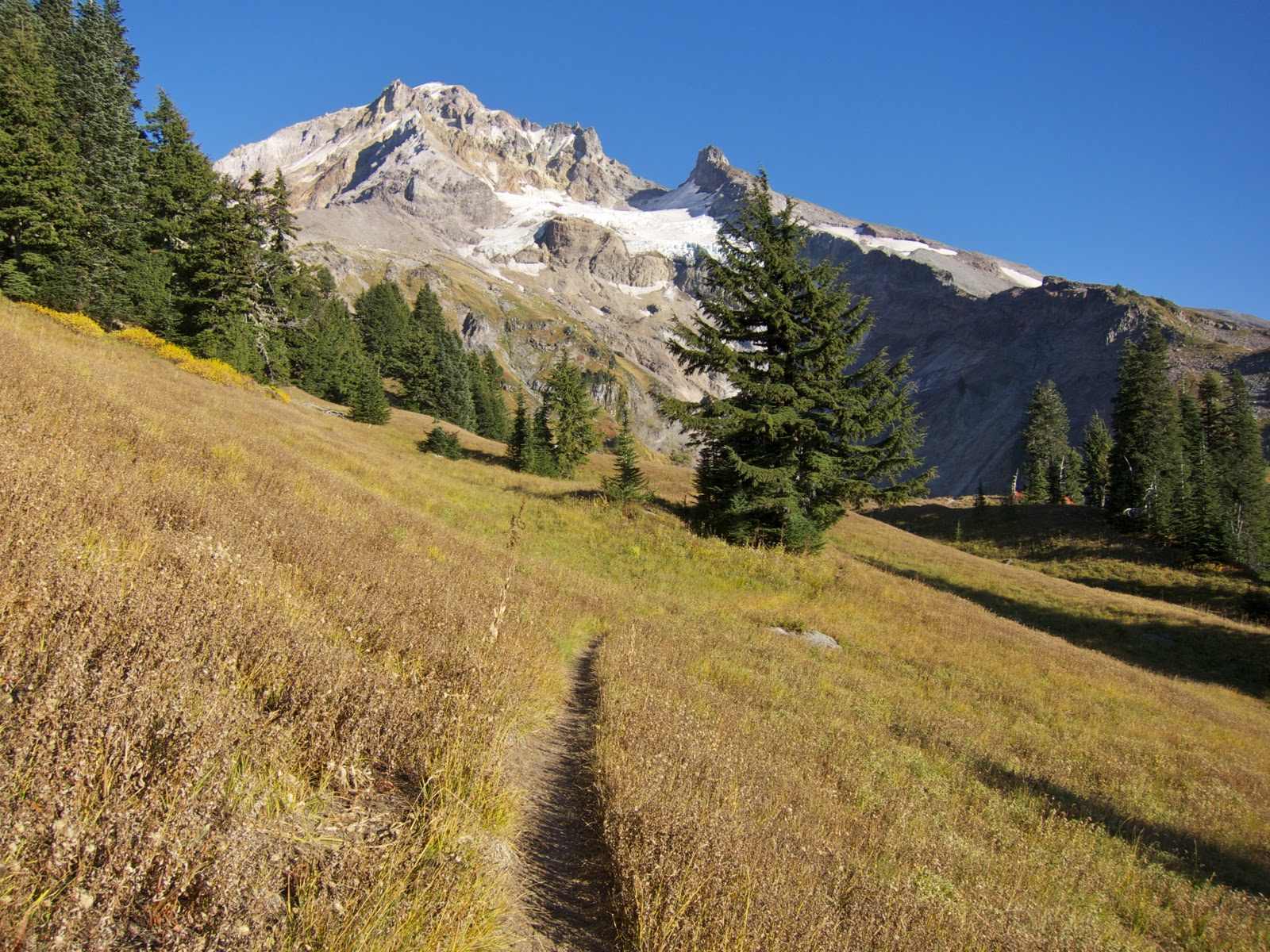
As I walked higher and higher, the trees thinned out gradually. When I finally saw Mt Hood, though, it was a sudden sight, and impressive. Now in the high country, my views were continually changing and beautiful.
I came to an overlook over into the headwaters of the Sandy River, with a good view of the Reid Glacier. There was a tiny spring near this overlook, and a little bit of a space to set up a tent, but I kept heading up hill.
I continued up the ridge, passing a few campsites, where the trail petered out. Here, following my guidebook, I scrambled up the field of loose rocks at a fairly high angle. It was no fun, and I wasn't sure I'd want to return along this route after sunset. I kept it up, though, knowing that an ungraceful descent by scooting down the rocks on my backside would be uncomfortable, but safe.
I arrived at a flat high spot on the ridge. There was plenty of non-technical terrain above me on the ridge, but I had had enough walking for the day, and didn't want to get too far from those campsites downhill, just below the rockslide. And the views were certainly satisfactory.
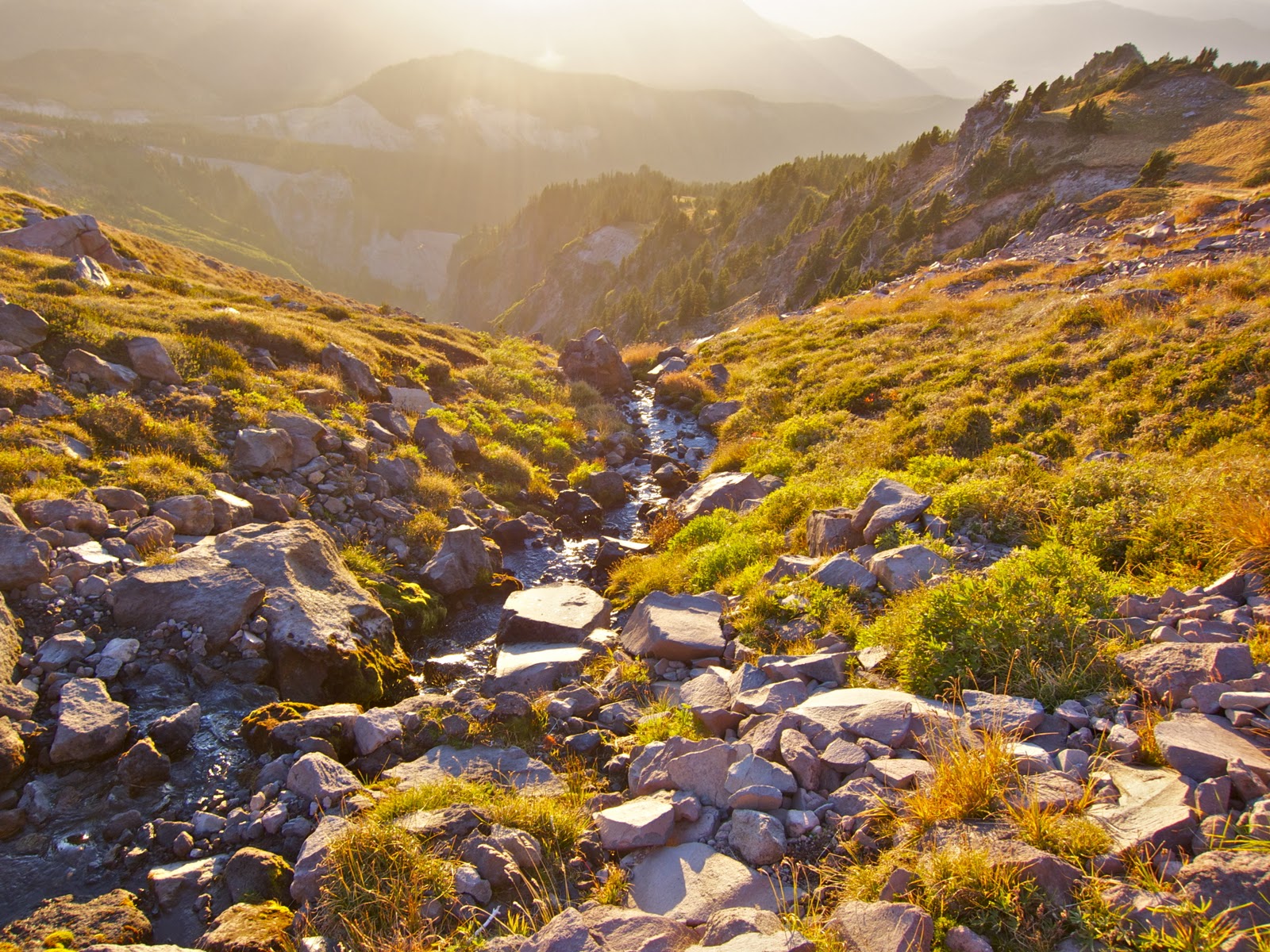
I still had one concern, though, and that was water. The campsites below were dry, and I was dry, too! So I did a little exploring. I figured that the snowfields in the above photo would have a good bit of melting going on, after a warm day like this one. So I walked over and found a very pleasant stream at the bottom of the nearest snowfield. I got plenty of water for the night and next morning. With that taken care of, I set about taking pictures.
Here's a long shot of Mt Jefferson, and beyond that, the Three Sisters. The Three Sisters are about 88 miles from Yocum Ridge, as the crow flies. I love being able to see that far.
I could also see the Columbia River from my high perch. I'm quite used to seeing the Columbia River from hikes in its Gorge, but it's quite a special thing to get to see it from such a remove. One tends to think of Mt Hood as a different locale than the river, but they're only about 22 miles apart. People are usually not far enough up to see the river though, through all the mountains!
Finally, some alpenglow on Mt Hood summit.
I walked back down in post sunset light. The rockslide was a big hassle, but by sliding on my butt for the steepest, loosest parts of it, I managed well enough.
As soon as I reached the campsite at the bottom of the rockslide, I set up my stove to heat up water for dinner, and got out my tripod for night pictures of the mountain. Here it is with a planet (Venus?) rising above the saddle next to Illumination Rock. Illumination Rock is called such because a bunch of men carried fireworks up there one July Fourth.
To my great surprise and appreciation, I turned around from photographing the mountain, and found that I could clearly see the lights of the Portland metro area 30 miles away. I've never seen Portland like this before, so I was very excited! I've fondly remembered seeing the lights of Honolulu from the ridge of one hike I did when I lived there. It was great to be up high and seeing down into the city where I lived. A nearly full moon illuminated the ground around me.
The next morning , I woke up to find the sunrise lighting up a small cloud over the summit.
Here's my campsite. Actually one of the best sites I've ever used. Except for the unnecessary fire ring. Since fires are not allowed at this elevation on the mountain, I took the opportunity to scatter the ring, a small pile of firewood, and the last fire's ashes. I like a nice fire, but it's really not necessary in such a place, where there is almost no firewood to be found.
I walked back down to my car, and stopped along the way to capture the color of the water in Ramona Creek, which was lit from above by sunlight filtering through yellow maple leaves.
I crossed over the Sandy River along its ravaged floodplain, as Mt Hood was covered in clouds. A few days later, a small snowstorm covered the Mt Hood high country in snow for the rest of the season. I was glad to have gotten my trip in when I did! I hope you enjoyed reading.