October 31, 2010

Coldwater Peak, Mt St Helens National Volcanic Monument, Mid October 2010

Back in mid October I took a day hike with my hiking partner up to Coldwater Peak, near Mt St Helens.  Traveling entirely in the devastated area north of the mountain, we could expect great views all around us.  When I hike in deep forests, I always wish there were some open viewpoints, and when I hike in treeless areas, I always pine for the cool shelter of healthy mountain forests.  I guess the grass is always greener.  Also, this area is famous for its huckleberry fields, so I knew I'd get pictures of the fall colors.  We were not disappointed!  We started by parking near the big and crowded Johnson Ridge Visitor's Center.  We got out of that mess pretty quickly.  

We headed up various ridges, walking into the sun.  As we left the crowds, we heard a helicopter take off, and we watched it head straight for Coldwater Peak.  It made a lot better time than we did!  When we finally got into the higher country, we started seeing the huckleberry fields.    


We also got some  views of the terrific scenery around us: Mt Adams in the distance, and Spirit Lake closer:


Looking back toward MSH, with Spirit Lake on the left:


This smaller lake is St Helens Lake, which a deep, rich blue.  This would be a great place to camp, but I'm not sure where one could find a spot free of downed trees.  In the distance is the white tip-top of Mt Rainier.


We climbed up the trail to the top of Coldwater Peak and heard people up there talking.  When we arrived, we talked to a crew working on a solar panel that powers a radio repeater for the Gifford Pinchot National Forest.  They were friendly and we talked about what it's like when your workday involves riding helicopters over volcanoes and getting dropped off to work on five-thousand-seven-hundred-foot-high mountain tops.  We also joked that we'd ask for a ride back down, which I'm sure they've heard before.  We found a quieter place to sit and eat our summit snacks.  We'd made really good time, and I'd managed to coerce my friend into sticking around for the good light at sunset, so we were in no hurry.  There's Mt Rainier again:


Walking back down open ridges to the low country:


Fall colors in a recovering wasteland, with St Helens Lake below:


As we walked down, we saw the helicopter lift the work crew from their high peak:


St Helens Lake again:


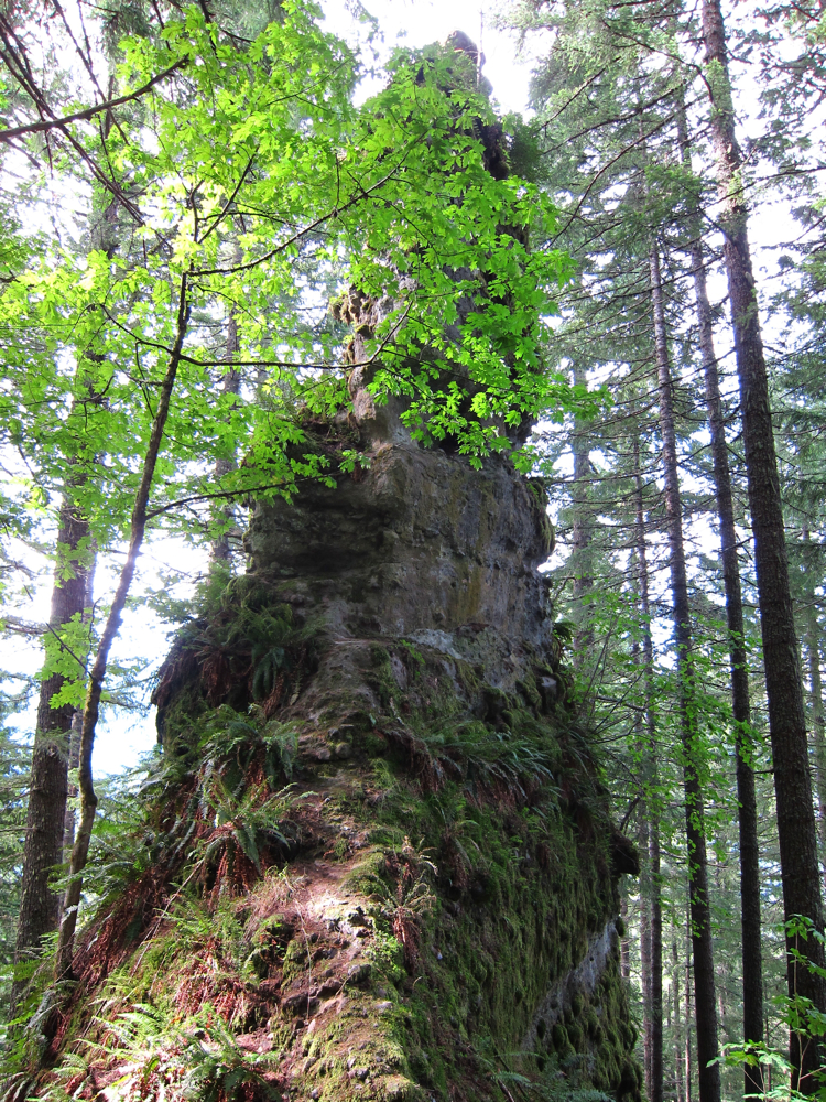
Along the way, we walked through a natural rock arch that cuts through the ridgeline:


My partner and the mountain:


Here's our last look at Coldwater Peak:


As we walked down the moon rose over Mt St Helens and the dry plains below it:


Mt Adams and Spirit Lake, with the corner of Harry's Ridge in the foreground:


Heading back:


Last rays of sun on the Boundary Trail:


Last light of the day.


Hope you enjoyed!

Day Trip to the Coast, late September 2010

Here are photos from a day trip to the coast with some family.  First, here's a nice old bridge over the creek at the the cove named the Devil's Elbow:


Here's Heceta Head from the cove:


And the beach:


Next, on to the tide pools at Cape Perpetua:


Sunset at from the beach at Cape Perpetua:


Then, up the road toward the town of Yachats, there's a pulloff with views of rocky shoreline.  YOu can't see it, but there's a big house right on the side of the hill to the left.  Seems like a precarious spot to me!


My trusty Honda in downtown Yachats.  I've been to this restaurant twice now, and had a great time both times.


Now driving back down Highway 101 to head back to Eugene, passing the Heceta Head lighthouse on the way.  


That's all for now!

October 29, 2010

Burnt Lake and East Zigzag Mountain Overnight, September 14-15, 2010

I took a trip in mid-September up to a lake I'd last visited a couple of years ago.  The lake is called Burnt Lake because a wildfire burned much of the area up before the turn of the century.  So unfortunately there's no old growth.  Even if the early white settlers hadn't logged so much of it off, the old growth suffered due to numerous fires that the whites started.  Though fire is a natural part of the forest's growth cycle, the pioneers caused fires at high rate.  So a lot was burned.  Indians set fires in the valley and along ridge tops in order to promote certain plant species and make hunting easier, as well.  

I walked up a second growth forest in beams of afternoon sun.  


I arrived at Lost Creek.


Here is the triple cascade of Lost Creek Falls, from above:


I got an early view of Mt. Hood from the trail:


I arrived at Burnt Lake a few hours after setting out.  This is a very crowded lake, in an area where any lake is a popular place.  I saw one other group of people there that afternoon, which wasn't too bad.  Hiking on weekdays tends to limit the crowds.  I feel sorry for people who have to hike on weekends!


Mt Hood from across the lake:


I walked up to the summit of East ZigZag Mountain, another mile and a half up.  From there I hoped to get nice views of the mountain at sunset.  While I waited for the sun, I cooked dinner and relaxed.  These distant buildings are actually quite large, and are part of the Timberline ski lift operation.


While dinner cooled off, I hiked around, looking for the best viewpoint.  Here's the mountain with Burnt Lake nestled into one of its radiating ridges:


The Cascades, looking to the south, with fall colored huckleberries:


Mt Hood in all its splendor, from East ZigZag summit.


I ate my dinner after the sun went down, and hiked back down to the comfortable campsites at the lake.  Along the way I noticed this little tidbit of post-recession humor on a trail sign.


At the lakeside, I discovered that the other campers had lit a fire (against regulations at this lake) and were playing a stereo and carrying on.  It's times like this that I'm reminded of why I don't normally camp in crowded places.  Even a weeknight can have this kind of silliness.  I don't know why some people need a radio and alcohol to enjoy being outdoors.  Personally, if I wanted that stuff, I could get it in town, where I can actually sit down in a comfortable seat and not be cold.  But, I think maybe these campers weren't really out there to enjoy being out there.  Seems to me that they bring these distractions specifically to distract themselves from the unpleasant parts of the experience.  I prefer a rich awareness of the quiet, cold and isolation.


Sunrise the next morning:


A terrific lenticular cloud built up over the mountain as I walked down to my car.


After returning to the car, I drove on to a very short trail to Castle Canyon.  This small area has a number of basalt crags, which are all that are left of a basalt plug.   Here are a few photos of the crags:


Finally, there's a peephole in one of the crags.  It's a steep rock face on the other side, so I didn't bother crawling through!


Hope you enjoyed!
Charley

October 27, 2010

Loowit Trail: Around Mt St Helens on Foot, Day 3 Video

Here's a brief video of fast moving clouds, at the foot of the Worm Flows.


October 25, 2010

Loowit Trail: Around Mt St Helens on Foot, Day 3


Since I woke up right in front of the mountain, I didn't need to even get out of my bag in order to get my sunrise shots.  Here's moonset  over Mt St Helens, just before sunrise (there's only indirect sunlight on the mountain).  I think that's Venus, to the left of the moon.  


A little while later, the sun rose on the top of the mountain, just as the moon disappeared behind it.  This is a telephoto close up.


The wider view, with the Plains of Abraham in the foreground.


After the sun cam up, I got out of bed and walked down the Loowit trail to close the loop.  Here's a view to the north.


Walking south on the Plains of Abraham.


At the edge of the Plains are several deeply cut canyons, with views down into the undestroyed forests near the mountain.  Also, one can see Mt Hood.


This is a view down into Ape Canyon.  Ape Canyon was named so after a troop of boy scouts reported being scared by a large ape like creature.  They later admitted that they were just kidding.  We still have Ape Cave and Ape Canyon, though.


Looking down the canyon.


That trail in the foreground is a favorite of local mountain bikers.  Seems like a tad narrow and steep for me, though.  It would be fun if it weren't so precipitous.


After curving around the southeast corner of the mountains, the trail enters another transitional area, where some burned trees stood after the blast.  And you can see more washouts up ahead.


These are the boulders of the Muddy River Lahar (mudflow).


Snags and heather growing along the trail, while the first clouds of the trip begin to build on the mountain.


Here are the headwaters of the Muddy River.  This washout was actually crossed by a very reasonable trail.


Basalt rocks at the bottom of the Muddy River washout.


Along here, the trail came to resemble other alpine areas in the Cascades.  This is as normal as the high parts of the Loowit trail ever get.


Mt Hood with park-like slopes.


This area was great for huckleberries.  Lucky for me, too, because there was still no clear water.  I decided this day not to carry any extra water.  Turned out there wasn't any clear water to drink anyway.  So the berries had a nice wet taste in the mouth.


Mt Adams above Mt St Helens' nice alpine park. I would love to see this side of the mountain during wildflower season!


Clouds continued to build on the summit rim, and I could see them creeping up the valleys below me as well.


Finally, the clouds came around the corner  and I walked inside them.


This area of lava flow is called the Worm Flows, and predates the recent eruptions.


Below the Worm Flows is a terrific forest of old growth Douglas Fir and Pacific Silver Fir.


I walked down out of the flows into the forest, where I continued to enjoy the huckleberries.  By the way, this is exactly the kind of image that my camera can do really well.  This was a hand held (one hand) exposure at 1/50 of a second.  The sharpness is really very good.  I just wish I could get that kind of sharpness on images of trees.


As the sun came back out, I walked down to June Lake, where I picked up some nice clean water and took a little nap.


I was hassled the whole time by this rather clever and somewhat domesticated Townsend's chipmunk.  It was fearless.  Obviously it's figured out that people will feed it if it comes close enough.


I walked back up and over lava flows


I walked up a heavily forested ridge, where I noticed a clearing through the trees.  I walked over to explore (it wasn't mentioned in my guide), and found a collection of towers and radio equipment.  This is a snow measuring site, or SNOTEL.  The equipment reads the amount of snow on the ground and relays it to an office of the US Department of Agriculture.  From there, it is published online.  The information helps land and water managers make decisions about water use for the upcoming summer.  Also, citizens can use these to determine if an area is snow free for hiking, or if there's fresh snow for skiing.  Pretty cool.


Terrific old growth pacific silver fir stands:


Finally, a nice walk back down through meadows to the Ptarmigan Trail.  I had passed by many spots that smelled of elk feces, but I hadn't seen any elk yet.  As I walked through this meadow, I blew my nose, and managed to flush out a herd of elk that had been hitherto unaware of my presence.  Oy!  That's not the first time that's happened.  I could have looked at them and taken photos (they weren't far off) at leisure, if I hadn't scared them off with my overactive nose.  Oh well. . . maybe next time!


Hope you enjoyed recollections from my trip.  I certainly did.