September 8, 2010

Columbia Hills State Park, Washington, August 18 2010

A friend of Laura's was visiting from overseas, and he was interested in seeing the dry side of the Columbia River Gorge.  I took them to a Washington State Park that I'd visited before, but we went to a different part of the park than the part I'd already seen.  This turned into a really beautiful trip.

First off, we started at the Dalles Mountain Ranch.  The preserve is basically all of the land of this once private ranch.  There's also a nice house, in addition to these farm buildings.  We had a picnic in the shade of the house.


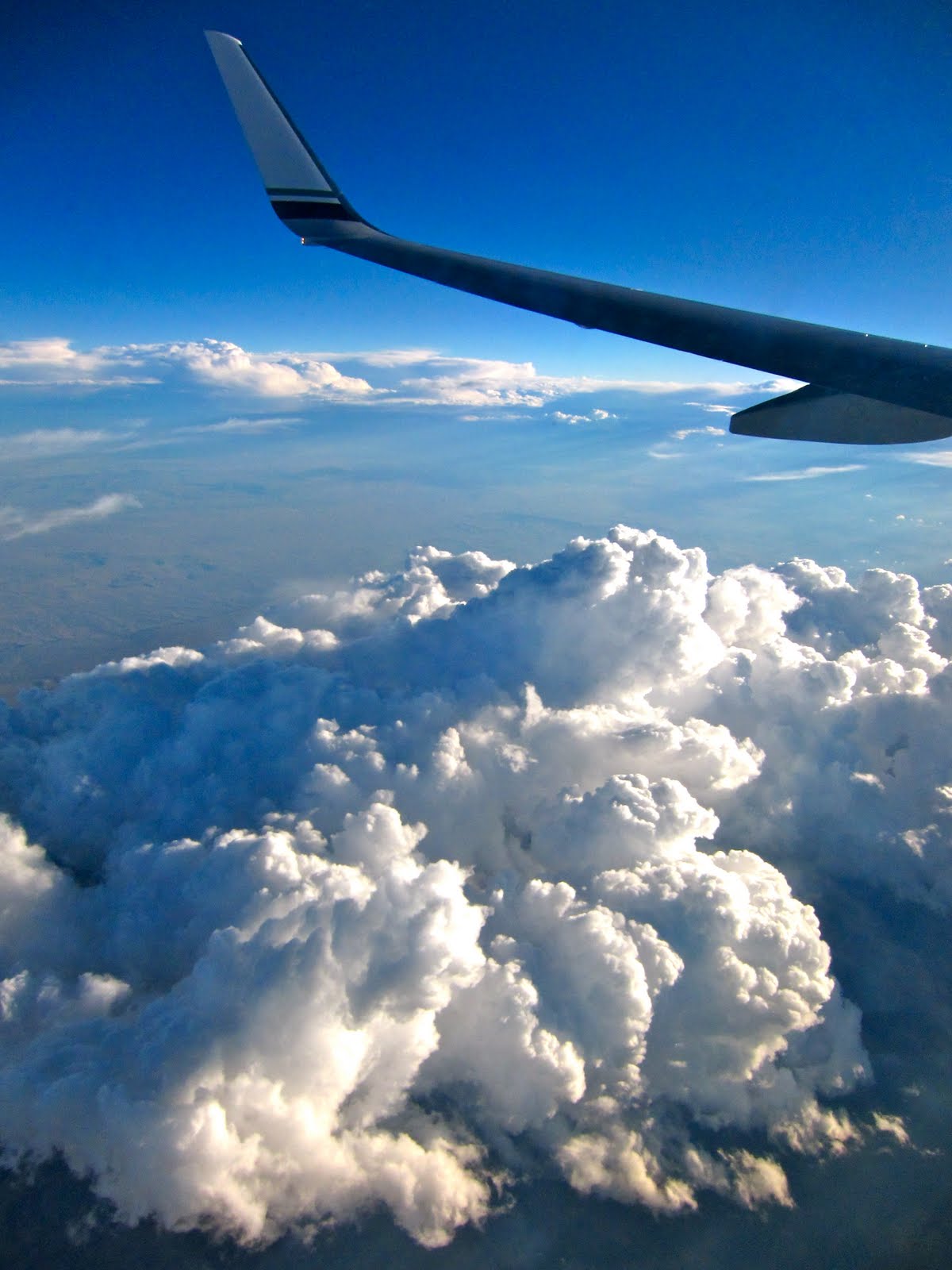
We drove a couple of miles up the hills to the trailhead, and set out.  Immediately we noticed large areas of dark clouds on the horizon.  It became clearer as we walked up the hill that these were brush fires, and we saw at least two separate ones.  This fire is burning the Fall Canyon area of the Deschutes River canyon.  I go backpacking here several times a year, and I'll be very interested to see how it looks next time I'm there.  Since there aren't really any trees to burn down, the main character of the place wouldn't be that different (I've actually seen before and after effects of fires in that canyon before, but I've never seen the fire itself).


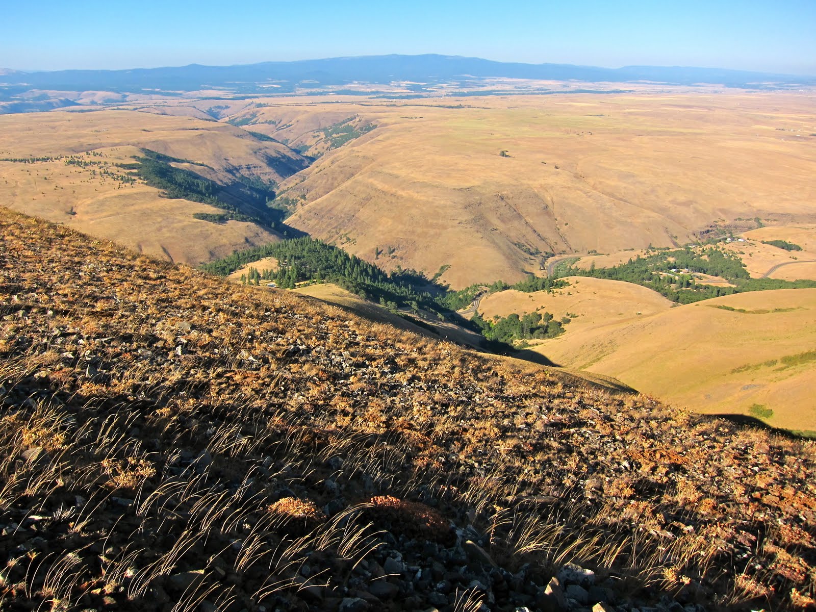
Once we got to the top of the Columbia Hills (their highest peak is called The Dalles Mountain, and that's what we climbed) we could see over into the Klickitat Valley below.  In the foreground is Swale Canyon, which I've ridden and walked in, and in the distance are the Horse Heaven Hills.  On the other side of that long ridge is the Yakama Nation.


Here's Mt Adams.  This face of the mountain is also part of the Yakama Nation.  The large canyon in the middle ground is the Klickitat River canyon.


Here's a radar or radio installation, part of a complex of buildings at the summit.  Some are commercial radio and cellphone towers, and other are part of the FAA air traffic control system.


We walked back down the hill in a real strong wind.  I had read the map and noticed "Oak Springs" was just around a corner from the main trail (which was a gated road).  We walked down toward the springs on an old roadbed.  Just as I was about to say "let's turn around and head back down," I saw a flash of water down the hillside.  I stopped and saw the spring.  I then noticed a buck drinking water from the spring.  Laura and her friend caught up to me, and we all stared at the deer for minutes, while he stared right back at us.  It was a magical moment, and I was glad that my somewhat obsessive little detour to examine a spring for its backpack-camping potential turned into such pleasant experience.

We reflected.  It was quiet and very isolated up there- perfect.


The red dirt and brown grass of deep summer, with a large forest of Oregon White Oak on the left:


Heading back down to the car:


There's the Columbia and Oregon across it.  At this distance, I-84 isn't as big and ugly as it is up close.  Also, you can see all the haze from the range fires.  


Here's the park, the river, the Dalles Dam, and the city called The Dalles, and of course Mt Hood, always stealing the show.  


Walking down in awe of the colors and quietude.  


Stretching out back at the car.


We saw several herds of deer on the way down.  Also, this is a closer view of The Dalles and the Dalles Dam.  


Interesting basalt formations, with moonrise.  This region is geologically characterized as "channeled scablands."  Cataclysmic prehistoric floods (calculated to be 500 cubic miles of water [!]) that washed down here all the way from Montana and Canada carved out huge channels in the layers of volcanic basalt laid down millenia prior.  


More rock formations


Mt Hood at its best.


On the drive home, we stopped by a park in Hood River called Panorama Point.  This is a 15 second exposure.  None of the foreground was visible to the naked eye, and only showed up after this long exposure on the camera.  


Hope you enjoyed reading this.  I'm done posting for a day or two!  

September 7, 2010

Washington from the Air, June 28, 2010

This is really stretching the primary mission of this blog, but fits into the goal of showing scenic photography.  Photos from a recent flight from Georgia to Seattle, on the way home to Portland.

Cumulus clouds over Montana.


Mt Rainier and the White River.  


Downtown Seattle, with West Seattle (built on Duwamish Head) on the other side of Elliott Bay, Puget Sound proper in the distance, and Vashon and Bainbridge Islands in the Sound.  Part of the Olympic Peninsula is at the back edge of the photo.


Capitol Hill and Washington Park, Seattle. 


The University of Washington Campus.


Lake Washington, with the Evergreen Floating Bridge in foreground, and the I-90 bridge in the distance, leading to Mercer Island (which is a real nice bike ride).


Downtown Bellevue, which is a pretty big city in its own right.


Beacon Hill, more or less.  


Intersection of South 128th and South Des Moines Way, which might actually be part of the town of Tukwila.  Cascades in the background.  


Touchdown at SeaTac.


Thanks for flying the photographic skies.

Bend on Bike, August 11-14 2010

Bend, in Central Oregon, is famous for its high and dry climate, its mountain bike trails, its mountain scenery, its outdoorsy way of life, and its extreme unemployment and foreclosure crisis.  There's also a music festival.  I worked every morning and every evening I was there, so I didn't get to photograph any great desert sunsets, but I did get to ride a bunch of trails, and some great roads as well.  I managed to fit two bikes in my car, so I could ride some road rides with a friend!

Here's a trail in Shevlin Park.  The trails here are dry and smooth.  The generally gentle contours of the land are ideal for riding a bike- less mad up and down than the wet side of the Cascades.


I used the trail in Shevlin Park to access a Forest Service trail called Mrazek, after a brand of bicycles once made in Bend.  It's a little bit of a celebrity, so I figured I'd get my picture with it:


Now, a photo from a road ride I took with a friend.  We rode out of Sunriver (where the festival is based) down to the town of LaPine.  Here's a big meadow which is part of the Deschutes River's original floodplain, I think.


Back to the mountains.  Here are photos from a ride up to Tumalo Falls and Swede Ridge.  Here's a ridge opposite the trail.  The higher area was burned in a fire, and has yet to recover.


Here's Tumalo Falls.  I don't know how this happens, but when I get on a bike, I start taking really mediocre photos!  Sorry about that snag in the way!


Continuing up in the mountains from the falls, I climbed for what felt like an hour, and finally reached a lovely ski shelter.  Did I mention that Bend is also legendary for its great snow skiing?  They've got it all over there.


Here's Swampy Lakes, near the shelter.  Really looks more like swamp and less like lake to me.


The trail back down Sweded Ridge was mostly fast and smooth.  This little section epitomizes the positive side of riding here.  The negative side is "moon dust" on the overused trails- the trail is ground into a fine powder during the hot summer months.


Here's a view of the High Cascades from Swede Ridge.


Finally, I took another road from my hosts' house.  It was just an exploration of their neighborhood, but on the east side of Bend, that means desert landscapes.  Here's one road I'd hoped to ride, after finding it on Google maps.  I found it was unpaved and not even graveled- my skinny road tires washed out in several inches of moon dust, and beat mercilessly on hard lava rocks.  If I'd been on my mountain bike, it would have been a fun ride.  Maybe next time.


Here's a little postcard of suburban Bend.  The city expanded with wild abandon in the 90's and 2000's, but the entire show came to a crashing halt when the housing market crashed.  Turns out lots of the jobs here were in building, selling, and furnishing second houses, houses for retirees, and in the tourism business.  The foreclosure rate is among the very worst in the nation, many owners are now underwater on their mortgage, and unemployment has been up in the mid teens.  A real economic and social disaster.


I enjoyed my travels in Bend.  Next time, I'm going to just go down there and camp out and get some good photos!

Still Creek Bikepack, August 8-9, 2010

Bikepacking is a new term, a portmanteau of biking and backpacking.  Bikepacking can be distinguished from bike touring in that rather than traveling primarily on open roads (paved or graveled or dirt, even), one travels on singletrack trails.  It is like backpacking, but with a bike instead of a pair of hiking boots.  Since traditional touring bikes are not usually comfortable for riding singletrack, one rides a mountain bike.  Since mountain bikes aren't really built for carrying luggage like a touring bike (saddle bags require a rack, and a rack requires attachment points which my mountain bike doesn't have), some riders have created fabric bags that tie onto various places on the bike frame.  The bags are sold by custom outfitters, mainly because the market is small, and every different bike, and even every different size of the same bike, requires slightly different dimensions in order to fit the frame.  So I don't have any!  I just use a backpack.  That can be sore on the saddle, but since I backpack ultralight, it doesn't weigh too much!

Still Creek is a 22 mile route using a historical wagon train route, the Barlow Trail, a few Forest Service trails, and a fairly long gravel logging road.  Up around Government Camp on the south side of Mt Hood, the scenery is beautiful, and it wasn't too busy, midweek.  This was actually the first day of a week long trip to Bend in Central Oregon.  Following my usual modus operandi, I'd camp on the first night and arrive the second day.  Much more fun than simply driving there!

Starting off at a reconstruction of one of the tollgates on the Barlow Toll Road.


I just read about the road, and it's fascinating.  It's worth reading about it yourself, if you're interesting.  Here's a link: http://en.wikipedia.org/wiki/Barlow_Road
In short, it was created to bypass the dangerous and expensive final section of the Oregon Trail- rafting down the Columbia River (and in those days, there were waterfalls where there are now locks!).  Parts of the road are now buried under modern highways, but some sections of wagon ruts are still visible.  Sorry, but I didn't travel those parts, and so there are no pictures.

From the trailhead, I traveled up a recently graveled utility corridor (I'm not sure, but I don't think that the pipeline was put in under extant ruts- the locals are pretty proud of the pioneer history and probably wouldn't have allowed that).


At a sign pointing to a campground, I got off of the utility corridor and onto the first singletrack of the ride:


Past the campground, I entered the Still Creek Trail.  This short trail really just climbs over a low ridge and into the Still Creek drainage.  It was short, and some sections were hike a bike (especially one section where the trail simply goes up a basically flat rock, sloped onto its side- it reminded me of the Appalachians), but other sections were just great!


At the end of the trail, I took a left up Still Creek Road.  It's a gravel Forest Service road with negligible traffic (it really goes from nowhere up and over a pass to a different nowhere).  I rode that for about 6 or 7 miles before finding a campsite on a spur road.  I'm not sure why, but I really didn't sleep well that night.  May have been the weather- while there was a predicted possibility of rain, it sure didn't look like it when I was up there, and I decided not to pitch the tarp.  I wondered all night long if it would start.  It never did, but I guess I was just keeping aware, just in case.

I headed back up the road the next morning:


I believe that purple flower is fireweed.

Bridge out!  That was a spur road, though, so I didn't have to brave my way across this mess:


At the end of Still Creek Road, I rode through another campground up to US 26, on which I cruised for about 200 yards before entering the town of Government Camp.  The locals call it Govy.  It's named so in honor of a US Army wagon train that abandoned a bunch of wagons when many of their mules died, en-route over the mountain.  Tough life back then!

In Govy, I used the facilities at the rest stop (I'm not above modern conveniences on my trips!), and then headed up into the small network of trails over the village.  The Crosstown Trail does exactly as advertised, and was a pleasant ride over to the west side of town:


Where I found one of the most idyllic locations for a port-a-potty ever:


This is actually the trailhead at the opposite end of the Barlow Trail.  So from here on out, I rode down the mountain to my car on the Barlow Trail.  This trail is mostly wide, at this point, and passes through some interesting areas.  Here's a bridge under the original Mt Hood Highway, which was built on top of Barlow's original route.


I pointed my wheel down, and flew down the mountainside.  Along the way, there were rocky, eroded sections, recently graveled sections, and pure mountain singletrack.  A real mixed bag, but fun nonetheless.  I also saw a mother deer with fawn on the trail.  They hoofed out pretty quick when i came around the corner!

Hope you enjoyed.


McKenzie River Trail MTB Ride, August 2, 2010

This trail, roughly near Eugene, is one of the most famous mountain bike accessible trails in the West.  People come from all over to ride it.  Since it's so near, and since it's rated at my difficulty level, I figured it was time to check it out.  I didn't have all day, didn't have a shuttle, and wasn't up to the more difficult upper reaches of the 26 mile trail (reputed to have lots of technically challenging riding on sharp lava flow rocks).  So I just did an out about back of the lower portion of the trail.  I was pleasantly unsurprised- the trail almost feels built for bikes, and is located in a beautiful protected area.  And the weather was great that day- just perfectly warm.

The wonderfully smooth and flowing trail was fast and fun.  Very well maintained and managed (no ruts from riding in wet weather).


Riding through big log cut in half:


It's nice to have a long legged bike- it fits me well.  It has 29 inch wheels, instead of the normal 26 inch wheels on a mountain bike.  A very smooth ride, even though there's no rear suspension.  Here it is with some huge cedar and Doug Firs.  Another little slice of heaven on earth!


I hope you enjoyed, and I wish you could have enjoyed it as much as I did.
C