June 29, 2010

Lake County, Oregon, Day 7: Derrick Cave and the Ponderosas

After walking 'round Fort Rock, I followed my driving map to Derrick Cave.  I'd tried to visit the cave earlier, but found that the road went through someone's front yard.  They'd put up intimidating signs, so I turned around.  I found a backroads entry to the cave, though, so I followed my map onto excruciating roads to get to the cave.  This trip was no longer than 20 miles, but it took almost 2 hours, due to the rough surface and frequent stops for navigation purposes.  I had to drive on sagebrush and pick my way through rock gardens, all the while hoping that I wouldn't shred a tire on a sharp rock or rip open my oil pan.  Fun times.  The Forest Service loves build roads, but can't be bothered to maintain most of them.  Here's a particularly steep grade.  I've got to figure out how to take better photos of road conditions, because these just don't do justice!


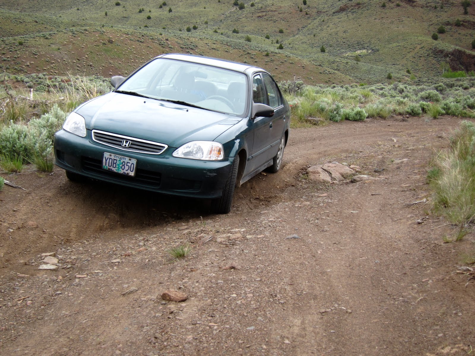
I also had to avoid large trees down over the road.  In this aspect, my timing was impeccable: traveling after Memorial Day Weekend meant that the many families who travel around with chainsaws (not so uncommon in this state!) had already cleared most of the real obstacles.  Here's one:


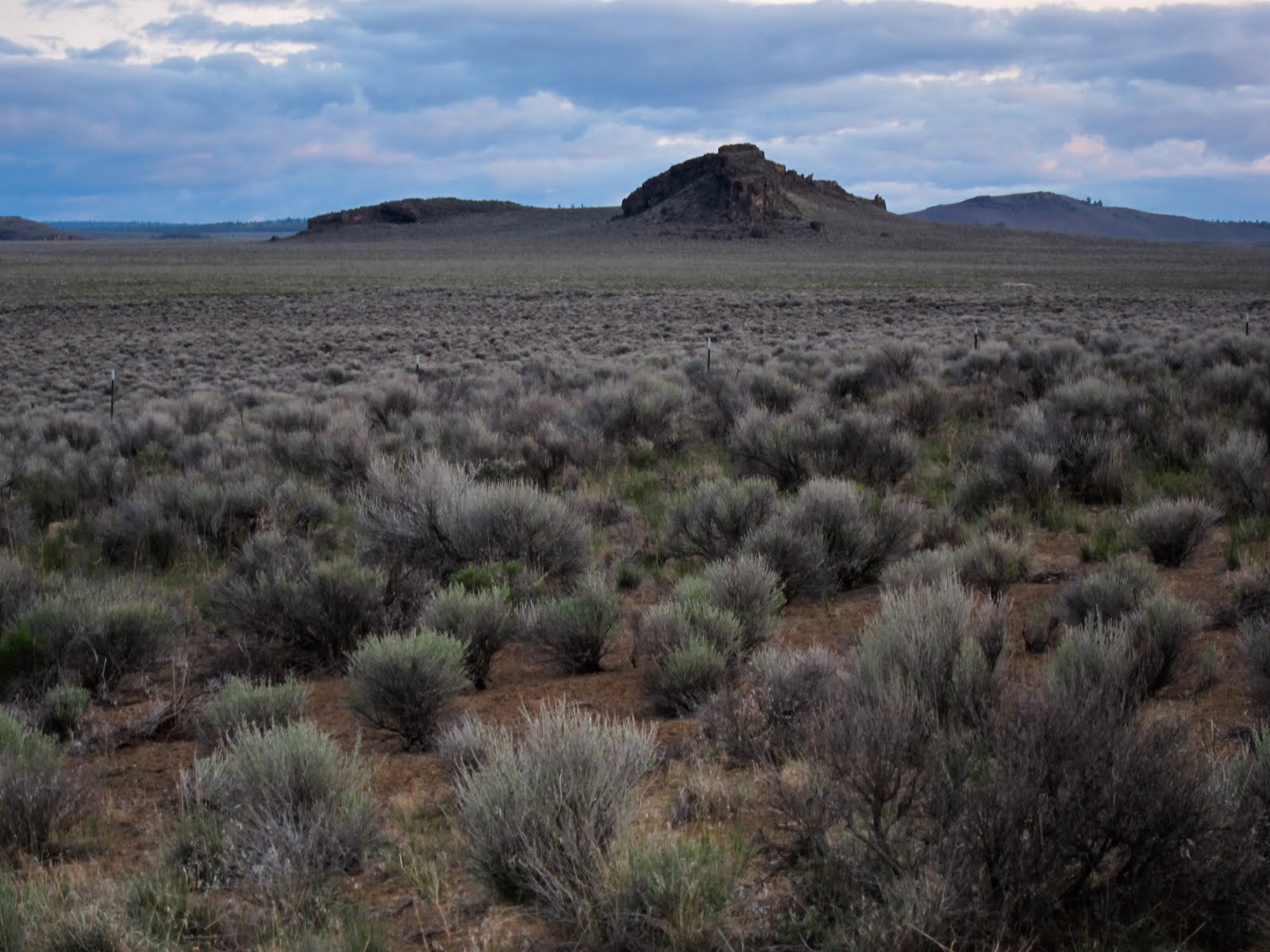
Coming up the road from Fort Rock, I passed from BLM (formed in 1946 by a merger of the General Land Office and the Grazing Service) into the Deschutes National Forest.  The boundary between environments was almost as sudden as the boundary between managing federal agencies:


In ecological study, this is called a ecotone.  Ecotones are zones of tension between one ecology and another.  Here it is Ponderosa pine woodland and sagebrush-bunchgrass steppelands meeting each other in a pronounced natural edge.  To the right, there is just enough moisture to support tree growth.  To the left, there's not enough.  The government boundaries literally follow this line in this place- BLM gets the steppe, and USFS gets the trees!

On to the cave.  Derrick Cave is one of the Northwest's many "lava tube" caves.  In short, when there is a volcanic eruption, lava flows downhill just like water.  While the lava flows down hill, the top most flowing portion of the stream interacts with colder ambient temperature air, but the lower portion is insulated by the upper portion.  The upper portion eventually slows down its flow, and freezes in place, while the lower portion of the flow, still insulated, keeps flowing out downhill.  Eventually, the lava stops pumping out of the vent.  The last bits of lava flow out the bottom of what is now a tube, and the inside harden and become solid basalt.  This will remain a void until the entire thing collapses.  In the meantime, parts of the roof collapse gradually, allowing humans entry from above.  Here's a skylight, showing the collapsed roof from inside the cave:


I've visited another one of these before, and they're awesome, fascinating, and totally creepy!  Every time I visit a cave, I think "this is going to be fun".  Then I stick my head in and the complete darkness and utterly foreign smell are overwhelming.  I start to have thoughts like, "maybe I shouldn't go in there!"  This one had a portion repurposed as a nuclear fallout shelter during the Cold War:


I went down into this portion, and all I could think about were nuclear mutant zombies.  The other side has a much larger cavern section.  It's like being inside a gigantic natural subway tunnel.  Note that there is no light down here, only what my headlamp and camera create.


Make sure to bring two flashlights, the brighter the better.

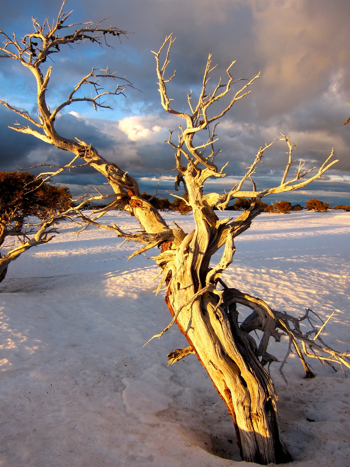
I also visited a pleasant part of the forest this day.  I got to see the Oregon state champion Western Juniper tree, which was a humongous specimen:


This was a special place- accessible only by very rough roads, and located in a grove of beautiful ponderosas.  I'd like to camp here sometime, but only if I can come in by bike instead of car.  It's just too rough to be a nice drive.  Here are photos of the ponderosas.  I've been trying now for a couple of years to take satisfactory photos of old growth, and I'm steadily improving:


From here on out, the roads improved.  Here's an odd place where a large power line easement bisects the forest:


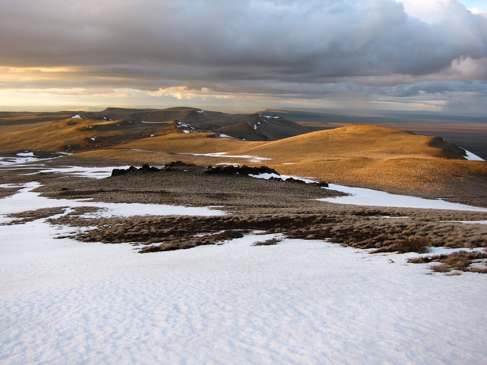
I drove back over the Willamette Pass into the Willamette Valley in a steady downpour.  This green forest and wetness were a little overwhelming after the aridity of desert country, even in the spring time.


I had a great trip, and I hope you enjoyed my reports!

June 28, 2010

Lake County, Oregon, Day 7: Fort Rock

After seeing the sun set on the dunes, I drove over to Fort Rock.  Using a Lake County District BLM map, I found a spot on a road nearby where I knew I could spend the night in my car (the Dunes are public land, but because of their high use by off roaders, there are regulations preventing camping on the roads in the area).  Fort Rock is an old volcanic feature eroded by the waters of a prehistoric lake.  It's a semicircular rock formation rising 200 feet above the surrounding sagebrush flats.  I hoped to get a morning light photo of it, but the sun was obscure behind clouds:


I drove around to the Fort Rock State Park, but it wasn't open yet, so I drove a little further to a viewpoint of Fort Rock Cave.  In the back of this cave, archaeologists discovered a cache of 70 sandals woven of sagebrush bark.  All were 9000 years old!  I presume the cave is off limits (I think it's on private property, actually).  The cave is in this miniature version of Fort Rock. 


At 6, when the park opened, I parked in the lot and walked around the inside of the Rock:


The sun came out a little, finally.


At the far end of the rock, one can see a "bathtub ring," where the Ice Age lake washed against the volcanic rock and smoothed it out.


Here is a photo of some odd cloud shapes:


From here, I next walked around the outside of the rock.  I saw an interesting flower.  No clue what it is.  If my guidebooks don't have it, there's no way to figure it out.  It's amazing that this so impossible to find on the internet.   


Also, I saw one of the irrigated crop circles that surround Fort Rock.  When I pass through the little towns out here, I see lots of towns with no restaurants, no hotels, no gas stations.  But just about every town has a drilling operation, so they're just drawing down that water table.  Wonder how long it will last?


This is the penultimate trip report from my Lake County trip.  Next and finally is Derrick Cave and the ponderosas of the Deschutes National Forest. 

Lake County, Oregon, Day 6: Fossil Lake Sand Dunes

From DeGarmo Canyon I drove quickly (I was searching for cell phone reception so I could let my dad know I was off trail before he sent called in an emergency) over gravel roads back to Christmas Valley. The weather was terrific for driving (lots of ominous clouds and cool temperatures- so much easier to enjoy the scenery when I'm not squinting and worrying about getting sunburn through the windshield). I drove between Rabbit Hills and Coyote Hills, through an area that the BLM seeded with several different kinds of grasses, in an effort to determine what would grow the best for cattle grazing.  I'm very interested in exploring the area of Coyote Hills.  It's listed as a Wilderness Study Area, and though it's probably ineligible for Wilderness designation (several roads and lots of mining history mean that it's not a "natural" enough area) I think it'd be a fascinating place to travel.


From there I drove back to Christmas Valley, and parked on a main road (the road to the trailhead was a muddy mess that would potentially strand my car) near the Sand Dunes. These are the largest inland dunes in the state. They're also a playground for Off-Highway-Vehicles. Luckily for me, this being midweek and rainy, it wasn't crowded.  I only saw a few quads.


There are some plants growing in the sand. Mainly there is greasebush and a few grasses.


Since I was just wandering in the dunes, soaking up sunset light, there's really no need for narration. Here are photos:


Hope you enjoyed.  Next Up- Fort Rock itself.

June 27, 2010

Lake County, Oregon, Day 6: DeGarmo Canyon Video

Here's a video of upper DeGarmo Canyon that I shot mainly for the sounds. There's the rushing creek, an eagle cry at about 25 seconds, and the sound of dry grass blowing in the wind. I don't think the dry grass comes across very well.


Enjoy!

Lake County, Oregon, Day 5 and 6: DeGarmo Canyon Overnight

I've been in the Wallowas working for the last week, and had no internet, and no free time.  That's why this last couple days' worth of trip reports had to wait.

After walking up Warner Peak in the evening, I got back to my car at about 11pm.  I pulled out of the trailhead parking lot and found an empty site in the nearby campground.  Just as I got tucked into my back seat for a night of deep recovery sleep, a nice light rain started up.  It was a great night to be inside, even if the inside was the cramped rear seat of a Honda Civic.  Actually, the several nights I've spent in the car in bad weather are all fond memories.  I can see why people travel in campers.  That would certainly be more comfortable.  Here's the campsite the next morning.


After getting up this morning I actually soaked in the hot springs.  I've never soaked in hot springs before, and it was pleasant.  A little weird to be sitting out in the open, in 100 degree water while its 50 degrees, with a light rain.  Getting out was cold!  I drove back to the Refuge headquarters for one last time, to fill out my last night's backpacking permit.  On the way, the cloud cover continued:


I drove back down the steep road to Warner Valley, then down the valley a ways to the head of DeGarmo Canyon.  I had walked up the pass from the Rock Creek drainage to the headwaters of DeGarmo Creek the day before, and today I would walk up DeGarmo Creek itself, and camp up in the Canyon.  As I packed up my backpack, I took in views of the Warner Mountains across the valley:


I followed my guidebook's route up the canyon, which was a faint boot path, and involved a good bit of scrambling.  It began with a small ford of the creek:


Up the creek farther, I explored some shallow caves.  They protected me from a small rain shower.  Being from the Southeast, and now living in the "Northwet," I'm not used to being dry in a rainjacket during a rainshower.  It's a neat feeling: though it's raining, and the jacket is wet, the overall humidity is so low that I dry out as soon as the rain stops.  The caves also had a nice view of a waterfall in the distance:


I followed my route up to the fall:


I scrambled up the canyon side to find an old cattle drive trail, which provided more pleasant walking for a way up the canyon.  As is typical for these Great Basin mountain ranges, the farther up I walked, the more trees I found, and the larger they became, until a certain point, when they started shrinking.  The vegetation patterns are determined by a fascinating and complex interplay of factors including sunlight, temperature, snow and rain fall, and soil content and depth.  Aspect (which direction the mountain slopes face) affects the amount of sunlight and precipitation.  Soil depth and content is affected, of course, by the amount of plants growing on the soil- in the Cascades there's sometimes a foot of loam on top of rock.  Here the best soils are washed down into the lowlands during spring runoff.  In this canyon, the microclimate of the mid elevation supports a varied forest of ponderosa pines and juniper, with cottonwoods and huge aspen groves in the riparian areas (next to the creeks).  Below this elevation, it's too dry to support ponderosa pines, and above, it's too cold or possibly too windy (I'm not sure).


I always forget how frustrating it is to try and photograph a canyon- the best light never makes it down below the walls of the canyon.  Here's some nice light on the higher country:


I managed to find a flat spot for my tarp under both a ponderosa and a juniper tree, growing together.  When I got up the next morning, it was raining.  Felt like a good morning to sleep in!


When I got up I walked up hill into more open country, with scattered ponderosa and juniper:


Above this, there are only a grove of aspen trees at the pass.  On my way up I spotted a baby pronghorn.  It allowed me to take a couple of photos, and then ran away:


I returned to the mouth of the canyon via the cattle drive trail.  Nice views of the west escarpment of Hart Mtn.:


Happy camper!


The worst part of this day's travel was the road back down to the Refuge's access road.  This photo doesn't do justice to the road's true awfulness:


Next up, Fossil Lake Sand Dunes!

June 15, 2010

Lake County, Oregon, Day 4: Warner Peak

Into each early season Eastern Oregon backpacking trip must fall some rain, and on my trip the rain started in earnest on this day:


After getting back to the car from Poker Jim Ridge, I drove to the Hart Mtn. Hot Springs campground.  At this point, I decided that I should go for a dayhike and return to the car and spend the night in my car in the campground.  (I just can't get interested in spending the night out under a tarp after a full day of pea soup and constant blowing rain- when it rains a little bit during the day, that's not too bad, but this all day stuff doesn't appeal to me).

From this area, the hike I planned was to walk up Rock Creek to a sheepherder's cabin, then bushwhack up Hart Mountain to DeGarmo Notch (a high pass), from whence I'd continue cross country to Warner Peak, which is the highest point on Hart Mountain.  I'd return partly by finding an old road and walking down the mountain on dirt roads.  This is William Sullivan's route (he writes the guidebooks for Oregon).  I think if I do this climb again, I'll just go up on the roads for the most part.  Easier walking that way.

Starting off in the rain, I had my camera in a waterproof container- an old peanut jar!  The first part of te route is a bushwhack up brush choked Rock Creek.  I felt
I was really happy when the rain stopped for a while and I was able to take a few photos of aspen trees and corn lilies next to Rock Creek.  The aspens on this side of the mountain are just beginning to leaf out, while on the other side, which is lower in elevation, the trees are already fully leafed.


As the small canyon of Rock Creek opens up into large Barnhardi Basin, the creek snakes around:


Just after taking this photo, the rain started up again, so I put the camera away.  Then, just after putting the peanut jar back in the bag, two adult pronghorn trotted up, within 100 feet of me!  They pranced around.  One of them started running up the ridge to the left, making a heroic silhouette on the skyline.  The other just stared.  They would have stayed put for pictures, but I decided that the photos wouldn't be worth the replacement cost of a waterlogged camera.  Oh well. . .

I came up to Barnhardi Cabin and took shelter inside, during spells of rain that were sometimes fairly strong.  It was nice to be inside, though the cabin is falling apart and leaking from most of the roof.  It stopped raining for good, while I waited in the cabin.


From here I slowly bushwhacked up the DeGarmo Notch.  I had originally planned on camping here, but I was glad I hadn't tried to do that after all- the whole area is a marsh, and I would have had to search for dry ground elsewhere.  Here I decided to go on ahead to the peak, rather than turn around and get back to the car for an evening of relaxation.  That would just have to wait, because the weather had really turned for the better, and the light was going to be nice.  Walking the two miles from the notch took a full hour.  I think that's pretty good, considering I was between 7,000 and 8,000 feet above sea level, and not walking on a trail.  I was happy to make the top.


There's a radio tower at the summit:


Here's a grove of mountain mahogany trees that I walked through on the way up to the summit:


Here's the broad summit plateau of Hart Mt. to the south:


I decided that, though the light was nice, I wasn't getting very dynamic images from the top.  That's often the case, because the summit of a mountain is usually just too distant from everything else.  Most things look just really far away, no matter the light.  I wanted to photograph the trees I'd walked through, so I started heading down.  I turned around to make sure I hadn't forgotten anything, and saw a rainbow!  It was way down in the valley to the east.  I spent the next five minutes making sure I got a photo.  Halfway through, I saw that a secondary rainbow had formed, outside the primary.  Here's a photo:


It's distant, but I was still happy to get to photograph it!  I headed down through the trees, taking pictures of a live tree, a snag, and the summit framed in a partly dead tree:


There was some snow walking, and some post-holing that made me wish I had snowshoes, but it was merely inconvenient.  Snowshoes wouldn't have been nearly worth the effort of carrying them up this far.  Looking back to DeGarmo Notch:


A cloud to the east:


One last shot of nice color came when I noticed light in the distance.  This is a hill in the refuge, and beyond it is Catlow Valley, which was settled by dry land farmers in the early 20th century, and abandoned soon after.


Walking down the mountainside after the sun had set, I was ecstatic.  I'd had such a good time, and was so glad I'd taken a chance on the weather.  A more reasonable person would have enjoyed a nice evening reading in the car in the rain, and gone for a walk after the rain let up.  After getting hit, I no longer automatically think "I can do that next time."  Instead I find myself thinking "I'd better do this now, while I can." 

The following is a 15 second hand held exposure (they don't say you can do that in photo class, do they?), showing the road I walked down on.  The weather was warm, the blue glow coming from the clouds was light enough to walk by, and I had just climbed a mountain.  Heaven.


Hope you enjoyed.