I took an overnight trip in late October that follows a classic route: up and over Tanner Butte, then down Eagle Creek back to the car. I've been to Eagle Creek several times, and have camped on the creek before. But Tanner Butte was brand new to me. Because of changing weather, the setting sun, and fallen snow, I didn't end up getting to the top of Tanner Butte. But I still had fun. Here are my photos:
I started out at the Oregon Department of Fish and Wildlife fish hatchery at Eagle Creek. Here are several spawning or post-spawn chinook salmon. These huge fish spend one year in the hatchery, then leave for the sea. After three or four years of getting fat on sea life, they return to the hatchery to spawn. They weigh from 10 to 45 pounds. I think that's why they're called "King" salmon. These are just a few of them. There are schools of hundreds crowding up the small creek!
They swim in circles or go up and down small riffles repeatedly. They seem to be aimless, but I think they're spawning. They change colors when they start spawning.
After spawning (they release eggs and sperm on the creek's rock beds with a vigorous method that looks like they're scratching their sides on the rocks), they rot from the inside out, while still alive. It's a really bizarre life cycle. The dead fish pile up, and the whole head of the canyon smells like dead fish. Here are a few trapped up in slack water in part of the fishery structures:
At the end stage of their life, they lie in the water, merely living:
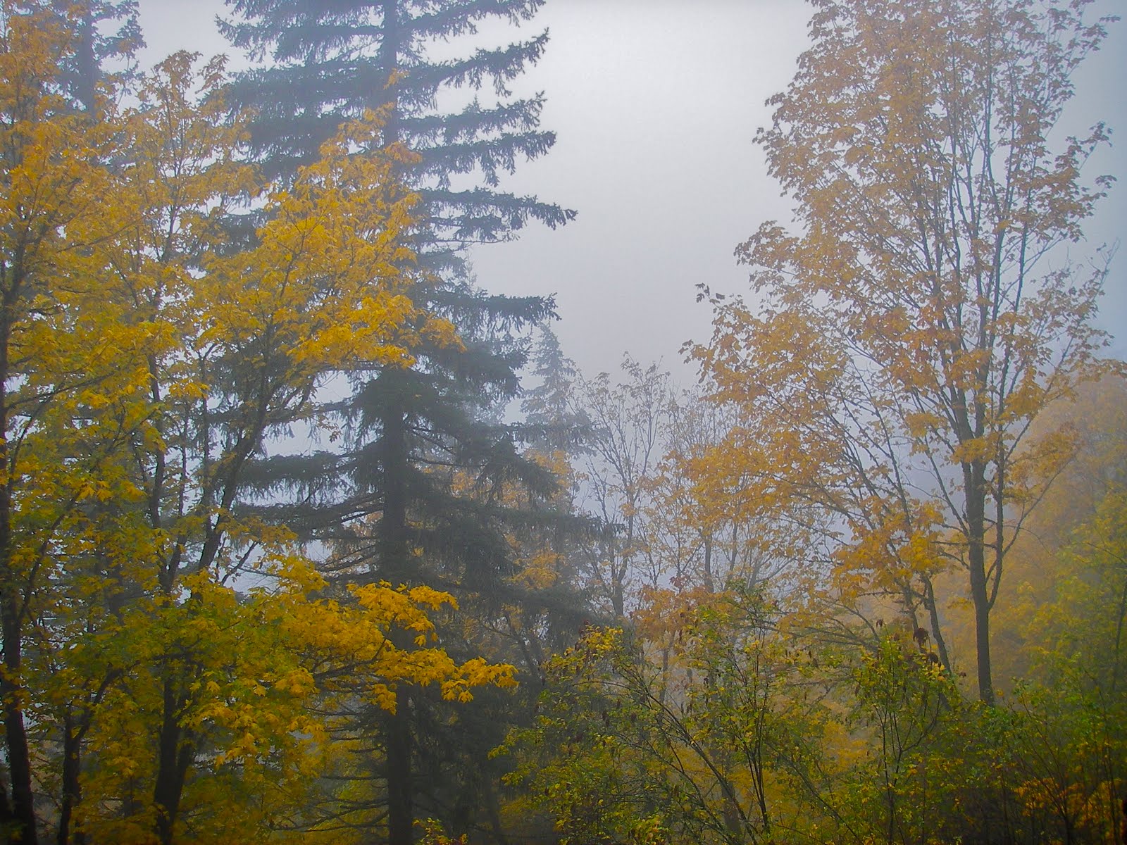
I walked up a ridge out of the Eagle Creek drainage. I found some nice views out of the forest to the Columbia, framed by fall color (the large clouded ridge at the background is Hamilton Mtn, which I've visited too many times to remember):
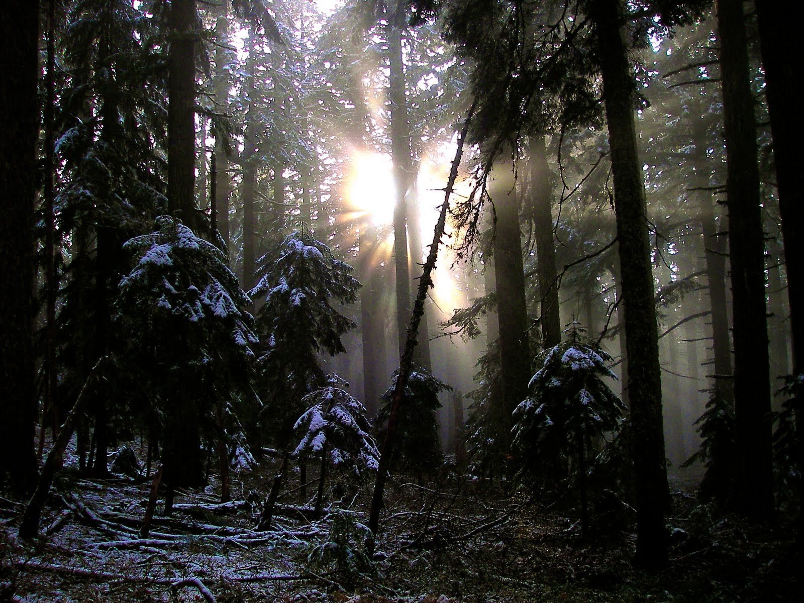
I walked up and and up the ridge on the Tanner Butte Trail. I entered a quiet second growth forest:
On the way, I noticed a wire running parallel to the trail. I found it again, several times, and at least once, found the wire coming out of the insides of trees. I'm pretty sure that this is a telegraph wire that was never cleaned up when it was decommissioned. There was a fire lookout on the top of the Butte, and possibly the line ran all the way to the lookout.
I didn't know whether or not I'd hit snow on this trip. In the shoulder seasons, sometimes I just head out and find out. I found a small amount once I got over about 3,000 feet. In positive news, the sun had actually started to come out of the clouds!
I took a left turn at a spur trail to visit Dublin Lake (and pick up some water to drink). The lake was surrounded by fall color, but I wasn't able to frame a satisfying composition without hand-holding the camera. And in the light conditions, I was unable to hold the camera still enough to avoid a blurry photo. I did, however, manage a composition of a nearby pond that had frozen over, along with a blazing red huckleberry bush behind it!

By this time, as usual, I was running slightly late on schedule. Well, not really. I try to time my trips so that I'm in the most spectacular locations (biggest views) in the hours right before sunset. So, while the sun was about an hour or two from setting, I was about an hour or two from the top of the mountain. My intended campsite (a creekside old-growth cedar grove) was some hour or so beyond that. After filling up enough water to get me to camp, I hightailed it back out the spur to the main trail, and walked up the mountain through increasingly deep recent snow.
The trail picks up and follows a very old, overgrown logging grade at this point. So I had no trouble following the route. As I walked along, I noticed a set of tracks in the snow. It looked like a coyote, while walking along the road in the opposite direction from me, turned right uphill and scrambled (lots of messy snow everywhere) up an embankment off the road. I thought that was kind of cool. Maybe it saw some prey.
I walked a little further, following the coyote tracks back from whence they came. I was only cursorily glancing at the tracks, when one of them made me double take:
That's no coyote! It's sort of hard for a person of my inexperience to tell the difference between canine (coyotes and dogs, because there aren't any wolves in Western Oregon) and feline (bobcat and mountain lion), but there are several clues that identify this as a mountain lion. Size is the first (the preceding coyote tracks were smaller) and shape (oval for coyotes, compared to roughly circular for kitties) is the second. I was really happy to see this, and to be heading in the opposite direction, too, as the sun went down. I'm guessing the kitty scared off the coyote. But that's a guess. Here are more kitty tracks:
Within a minute of taking this photo, I walked up on a buck deer, also walking down trail, just like the coyote and cougar. It's an interesting thing. Surely he smelled the cougar's passage?
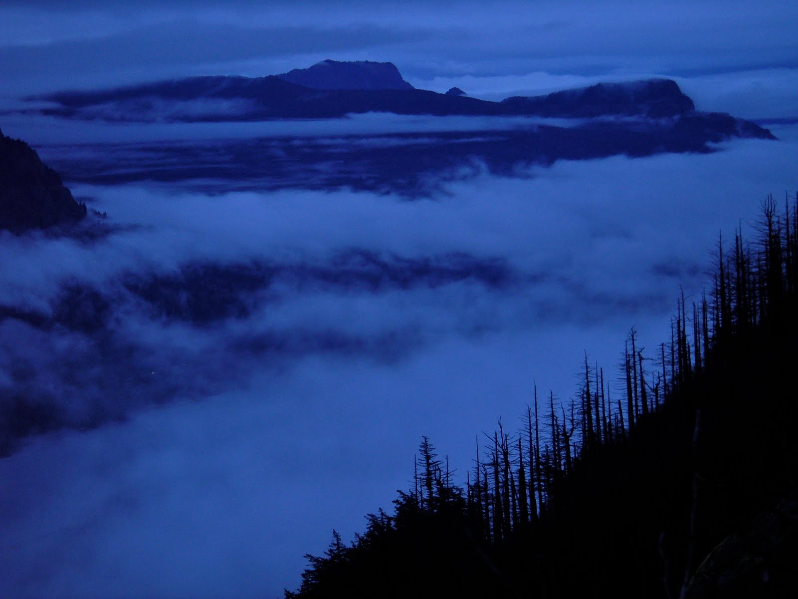
As I approached the summit, the clouds covered up most of the mountain, and the light grew dimmer yet. In light of my small supply of water, the large supply of snow covering the route, and the low supply of light for photography and navigation, I opted not to take the bushwack-spur up from the road to the summit. While it's a neat feeling to be at the top of a mountain in a white-out, I decided I'd like to come back when I can take some nice sunset photos. One further concern was that the night was predicted to be rainy/snowy, and I didn't want to be stuck high on the ridge, weathering a deep snowfall in my tiny tarp.
I did get one photo of the summit area of the mountain, from a meadow on the ridge, though:
I walked along the ridge's road, hoping that the trail leading down the canyon to my campsite would be marked. Otherwise, it might have been hard to see, especially given that I was now using my headlamp for illumination. Sure enough, the Forest Service came through, and the trail was clearly marked. I took the left turn, and headed down.
The snow was less prevalent the lower I went. But this trail was badly overgrown. I hike at night very often (it goes with the sunset on the summit photography strategy), and am quite comfortable negotiating trails in the dark. But this one was so overgrown and occasionally eroded by seasonal water flows (which make their own "paths" that intersect the trail, and create a braided mess) that I dropped off trail several times. Once off, I would stop and slowly walk in a spiral until I found the trail. Or sometimes it made the most sense to back up and try again. Often I'd find the tread of the trail in great shape, buried under dark masses of overgrown bear grass.
One time, the trail clearly led straight into a small pond. The pond was on my map, which was heartening, but appeared to stop right there. My feet were already quite wet from the snow, but I wasn't interested in finding out how deep the water would be. I backed up and tried again, thinking I'd missed the real trail, but it clearly led to the lake. Finally, I noticed pieces of wood in the lake, spaced at footstep intervals. I took several steps out, and as my headlamp lit up the lake, saw that the trail led right through one corner of it, right on partially submerged steps made of a cut up tree! After this, the going got a little easier, and I made it to the campsite. The cedars were huge and inviting. I slept soundly.
I woke up to rain. So I stayed in the tarp for a good hour, just psyching myself to get out of bed and hike 12 miles down the canyon in the rain. And enjoying the pitter patter of our very civilized, polite northwestern-style rain. I made it out of my tarp and hacked my way down the still quite overgrown trail. I even lost it briefly in the daytime! There was a deep and rushing ford of Eagle Creek, and a long walk out, down a trail I've been down several times. I was wet, and really ready to be out, so I made the 12 miles in something like 4 hours of steady walking. During the walk, I managed to convince myself I needed new rain jacket. Mine was so ripped up and wasn't that protective in the first place that I felt like just throwing it away! It's done well, though, considering it cost me $10, weighs a few ounces, and has been used continuously for about two and a half years.
There's only one photo from the second day, really. Just a shot of Eagle Creek from a bridge about halfway down. It's hard to get the camera out on days like this: I didn't feel like stopping and cooling down, I've never made a satisfactory photo of the spectacular falls along the creek, and my lack of a full size tripod means I'm limited in my compositions, given the low light.
My car was warm and dry, and I was back in Portland within 45 minutes. Isn't it great to live in a place like that! Hope you enjoyed.