Since I woke up right in front of the mountain, I didn't need to even get out of my bag in order to get my sunrise shots. Here's moonset over Mt St Helens, just before sunrise (there's only indirect sunlight on the mountain). I think that's Venus, to the left of the moon.
The wider view, with the Plains of Abraham in the foreground.
After the sun cam up, I got out of bed and walked down the Loowit trail to close the loop. Here's a view to the north.
Walking south on the Plains of Abraham.
At the edge of the Plains are several deeply cut canyons, with views down into the undestroyed forests near the mountain. Also, one can see Mt Hood.
This is a view down into Ape Canyon. Ape Canyon was named so after a troop of boy scouts reported being scared by a large ape like creature. They later admitted that they were just kidding. We still have Ape Cave and Ape Canyon, though.
Looking down the canyon.
That trail in the foreground is a favorite of local mountain bikers. Seems like a tad narrow and steep for me, though. It would be fun if it weren't so precipitous.
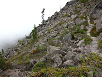
After curving around the southeast corner of the mountains, the trail enters another transitional area, where some burned trees stood after the blast. And you can see more washouts up ahead.
These are the boulders of the Muddy River Lahar (mudflow).
Snags and heather growing along the trail, while the first clouds of the trip begin to build on the mountain.
Here are the headwaters of the Muddy River. This washout was actually crossed by a very reasonable trail.
Basalt rocks at the bottom of the Muddy River washout.
Along here, the trail came to resemble other alpine areas in the Cascades. This is as normal as the high parts of the Loowit trail ever get.
Mt Hood with park-like slopes.
This area was great for huckleberries. Lucky for me, too, because there was still no clear water. I decided this day not to carry any extra water. Turned out there wasn't any clear water to drink anyway. So the berries had a nice wet taste in the mouth.
Mt Adams above Mt St Helens' nice alpine park. I would love to see this side of the mountain during wildflower season!
Clouds continued to build on the summit rim, and I could see them creeping up the valleys below me as well.
This area of lava flow is called the Worm Flows, and predates the recent eruptions.
Below the Worm Flows is a terrific forest of old growth Douglas Fir and Pacific Silver Fir.
I walked down out of the flows into the forest, where I continued to enjoy the huckleberries. By the way, this is exactly the kind of image that my camera can do really well. This was a hand held (one hand) exposure at 1/50 of a second. The sharpness is really very good. I just wish I could get that kind of sharpness on images of trees.
As the sun came back out, I walked down to June Lake, where I picked up some nice clean water and took a little nap.
I was hassled the whole time by this rather clever and somewhat domesticated Townsend's chipmunk. It was fearless. Obviously it's figured out that people will feed it if it comes close enough.
I walked back up and over lava flows
I walked up a heavily forested ridge, where I noticed a clearing through the trees. I walked over to explore (it wasn't mentioned in my guide), and found a collection of towers and radio equipment. This is a snow measuring site, or SNOTEL. The equipment reads the amount of snow on the ground and relays it to an office of the US Department of Agriculture. From there, it is published online. The information helps land and water managers make decisions about water use for the upcoming summer. Also, citizens can use these to determine if an area is snow free for hiking, or if there's fresh snow for skiing. Pretty cool.
Terrific old growth pacific silver fir stands:
Finally, a nice walk back down through meadows to the Ptarmigan Trail. I had passed by many spots that smelled of elk feces, but I hadn't seen any elk yet. As I walked through this meadow, I blew my nose, and managed to flush out a herd of elk that had been hitherto unaware of my presence. Oy! That's not the first time that's happened. I could have looked at them and taken photos (they weren't far off) at leisure, if I hadn't scared them off with my overactive nose. Oh well. . . maybe next time!
Hope you enjoyed recollections from my trip. I certainly did.


No comments:
Post a Comment
Please feel free to leave a comment!