May 27, 2010

Mt. St. Helens National Volcanic Monument, Coldwater Lake and the Hummocks, May 2010

Here are photos from my first trip with my new camera!  The new camera is not waterproof, but it does have a fast, wide angle lens (YAY!!!), a large sensor, and is capable of fully manual control.  I still have to shoot good photos, but my vision comes through more clearly with this camera.

Mt. St. Helens blew its top off 30 years ago, and the landscape nearby still shows the effects of the massive disruption.  The main blast was actually something like 50 times the energy release of the H-bomb at Hiroshima, though without the radiation.


First I walked a short trail through the Hummocks.  This is an area of deposited debris from the mountain's north side.  When MSH blew, the material flowed down the drainage of the Toutle River in a giant mudslide called a lahar.  The mud has eroded over the years and left Badland like shapes.


The depressions in the Hummocks filled up with water and there are now dozens of smalls lakes and ponds, where there are many water birds.  Some beavers have even moved in.


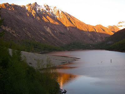
After finishing the Hummocks loop, I drove over to the trailhead at Coldwater Lake.  The blast dammed up Coldwater Creek and enlarged a small lake to many times its original size.  Now its as big as many US Corps of Engineers reservoirs.


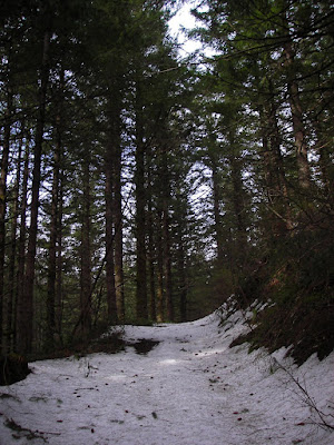
The trail ambles pleasantly along the north side of the lake.  Most of the time, I had great views of Minnie Peak.  This peak is easily climbed from its northeast side, but looks imposing and impressive from the southwest side.  I wonder what it looked like before its trees were blown down.  


Of course, lots of views of the lake and surrounding mountains to the west as well.


As is normal for me, I planned to be out hiking during the best light, and I got lots of it!  No need for captions on most of these.


With the exposure controls possible on this camera, I can make as long as a 15 second exposure.  And with a top ISO of 3200, that's a good bit of light.  This image was made one hour after sunset.  


This image was made a little later yet:
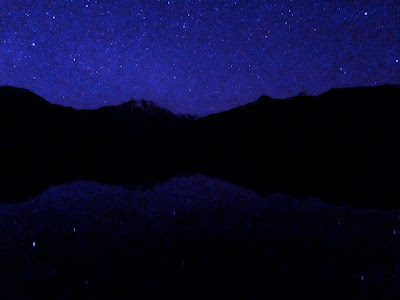


After getting back to my car, I drove out a ways, and pointed my camera to where I though I'd see Mt. St. Helens.  It was so dark that I couldn't really tell where to aim the camera, except by trial and error.  The light on the right side of the image is from the Portland/Vancouver metro area. 


Hope you enjoyed!

New Camera!

Here are a few pictures from my new camera:


Next up- Coldwater Lake, near Mt. St. Helens.

May 19, 2010

Deschutes River Bike Camping, May 5-6, 2010

Here are photos from a recent trip up the Deschutes River.  I've been here so many times and I think all of my family has read enough about this river, so I'll try to keep my comments brief.  Try.

First off, here's my trusty steed, saddled up and ready to go:


I've done this trip on a mountain bike before, and I think it's easier.  Though it is possible on a touring bike with large tires (40c), it's easier on a mountain bike with larger tires (2 inches).  Just a more comfortable ride.  On the other hand, this is the bike that I had available, and the drop bars came in handy for the occasional headwind.

I got a headwind and no rain, the entire ride upstream.


I once climbed up to the rim of the canyon, and came back down by these power lines.  They're abandoned now, and I wondered when they were put in, and what it was like to be on the crew putting them in.


I reached the end of the (barely) maintained path.  Beyond this point, there are several ornery portages past drainages for which there are no trestles remaining.  Beyond that is a good gravel road (public) with camprgounds.  A long loop awaits me, when I've got the legs for it.  More on the loop later.


I found a nice spot to camp.  While my dinner was readying itself (I love home made boil in a bag meals!), I took photos of the sun setting on clouds around the canyon.  While it's a beautiful canyon with big views, the fact that the best sun of the day only hits the top of the canyon rim (often obscured by irregularities in the canyon walls), while the rest of the canyon walls are in near darkness, makes it hard to photograph to its greatest potential.  The answer is to be along one of the high ridges at that time of day.  Simply requires doing.


I put up the tarp, just in case.  It did in fact drip a wee bit of rain shortly after I hit the sack.  Here's my camp the next morning.


There were several nice wildflower displays.  Here's one of small pinkish flowers:


And the ever popular lupine:


On the way back to my car, I saw rain clouds and heard thunder.  I hightailed it (well, not really all that fast, but I tried) to Colorado camp, where I sheltered under the outdoor awning of a concrete pit toilet.  No point getting wet if you don't have to!


Dramatic clouds at the mouth of the canyon.  Stacker Butte in the distance:


After arriving at my car, I decided to take a scenic drive around the canyon.  Up Fulton Canyon Road, up gravel and dirt farm roads, down state route 216 to Sherars Bridge, and up US 197 back to The Dalles.  There exists, in variations on this route, a terrific touring potential.  The only problems are few sources of water and few campsites.  It is possible to do the route, though.  Another option would be to simply ride around on the plateau above the Deschutes.  Either the east or west side of the uplands would be nice, though the east side is more open, and there seems to be more mileage of gravel roads.  A trip for strong riders, that's for sure.  Here's a taste.  It's almost Iowa like.


Hope you enjoyed!


May 17, 2010

Silver Star Mountain, April 2010

Here are photos from recent hike up Silver Star Mountain.  I went photo wild, considering this was an afternoon and evening hike, not a longer trip.  But I find the big views of snow covered mountains irresistible.  These kinds of views are one of the few things that my old camera did well (besides remaining functional underwater).

I began hiking in sunny skies and 60's Fahrenheit.  Felt like summer in the high mountains.  The entire route is on old logging roads, which makes it a particularly good hike for this time of year.  Singletrack trails are easily obscured under 5 or 10 feet of snow, so it's much easier to follow roads.  This road is getting washed out by a spring underneath it.


I quickly came to snow.  It wasn't bed, though, because it was trackless and soft.  Tracks tend to create a mess of things, and make it hard to walk on the snow without slipping.  


After several miles of steep uphill, and after donning my snowshoes, I finally got to the big views.  Here's Pyramid Rock, on a ridge across from mine.  Visible are the unique linear tree plantings that are evidence of this mountain's past.  It was burned quite viciously in the 1902 Yacolt Burn fire.  This forest fire, the largest in Washington's history, killed 38, and left the top of Silver Star denuded.  Landslides following the fire swept away the layer of top soil, preventing large stands of timber from growing successfully.  The area was replanted in rows, oddly, and even though the trees are many decades old, lots of them are barely head high.  


Snowshoes are an incredibly useful tool for getting out into the mountains for the winter.  They allow me to tackle more steep slopes and brushy areas than skis ever would.  If I had tried to walk up here without them, I'd sink in one to two feet every step, and would be basically wading in the snow.  It's slow progress, even with the snowshoes!


After hitting the open hillsides, I noticed the sun giving way to clouds.  Heres the view to the east, of Bluff Mountain.  


My tracks coming up the south ridge.


This was the only difficult spot of the trip- it was pretty steep, and the road grade disappeared underneath wind-driven snow.  Kind of nervy, for a boy raised in Chattanooga.  I think locals here are totally used to high angle snow travel.  


Here I am at the summit, just as the sun is setting.  That's Mt. Rainier in the distance.  Look familiar, Mammer?


Here's Mt. St. Helens.  I've been to the top of that one, too.


Here's Mt. Hood.  The trough between me and Hood is the Columbia River Gorge.  Locals can probably pick out Devil's Rest above the Gorge.  


Finally, the sunset was just so-so.  This was the best I got, as the sum was obscured by our lovely 8 month companion, the coastal clouds.  The snow plastered rock in the foreground is called Sturgeon Rock, and it provides a viewpoint of Silver Star at Sunset.  That'd make it a nice destination, come to think of it.  Must do!

Hiking with Laura, Spring Break

Laura and I took a two night backpacking and hiking trip in the Columbia River Gorge, during our spring break.  I was concerned that my back would give me trouble, after sleeping on the ground.  But, in fact, my back and neck felt the best they had felt in a long time.  I guess sleeping on the ground isn't that bad after all.

First we went to Catherine Creek.  Located on the Washington side of the Columbia River Gorge, this Forest Service property is known for great sunny weather, terrific wildflower displays, and wide open views.  I've camped here more that any other single place (with the possible exception of the Deschutes River, which also has great weather and big views).  Here's a small field of desert parsley, in a grove of Oregon White Oaks.  This tree is the only oak tree native to Washington State.


The views did not disappoint, of course.  Here's Mt. Hood, over the open grassy fields of Tracy Hill.  


Here's the view to the east, with Rowena Crest on the Oregon side and the Columbia Hills on the Washington side.


We spent a very pleasant evening camping just above a small pond that has been dug into the hill at the location of a small spring.  The fields used to be ranch land, but all the cattle and fences are now gone.  Laura was cold, of course, but she made do.  Here's our room with a view.  


The next morning, we drove back west to a distinctive mountain called Wind Mountain.  It's known for views of the Gorge and for Indian vision quest pits.  It's an important archeological site, and though the trail's not on any maps, there were lots of people on it.  We got one nice person to take a photo of the two of us.  That's Mt. Adams in the distance.


We next drove farther west to the area around Table Mountain.  On a previous hike of Table Mountain, I remember finding a great campsite near Gillette Lake.  I'd had visions of camping there for the last year or two, so I finally got my opportunity this trip.  We walked on the PCT through clear cuts and power line easements.  We got a view of Beacon Rock.  


At Gillette Lake, we could see Hamilton Mtn and Table Mountain.  We headed down and looked for the great campsite.  It wasn't right where I expected it, so I looked around some more.  Still couldn't find it!  We eventually gave up, and found a fine enough place (just not as nice).  


We cooked dinner.  I had read a weather forecast that didn't predict rain, so I initially planned on sleeping under the stars.  After dinner, though, clouds covered up the stars, so I pitched the tarp, while Laura fell asleep.  As soon as I had it pitched, it started raining.  Good timing!  I got into my sleeping bag, and fell asleep.  I woke up again, when I could feel the tarp against my face.  It had fallen down on top of us.  Laura didn't even wake up as I got out of the bag and pitched it up again.  Grad students sure sleep well, huh?  We got up the next morning in light rain that eventually let up as we roused ourselves and walked out.  It was a nice spring break.