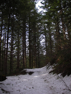
I began hiking in sunny skies and 60's Fahrenheit. Felt like summer in the high mountains. The entire route is on old logging roads, which makes it a particularly good hike for this time of year. Singletrack trails are easily obscured under 5 or 10 feet of snow, so it's much easier to follow roads. This road is getting washed out by a spring underneath it.
I quickly came to snow. It wasn't bed, though, because it was trackless and soft. Tracks tend to create a mess of things, and make it hard to walk on the snow without slipping.
After several miles of steep uphill, and after donning my snowshoes, I finally got to the big views. Here's Pyramid Rock, on a ridge across from mine. Visible are the unique linear tree plantings that are evidence of this mountain's past. It was burned quite viciously in the 1902 Yacolt Burn fire. This forest fire, the largest in Washington's history, killed 38, and left the top of Silver Star denuded. Landslides following the fire swept away the layer of top soil, preventing large stands of timber from growing successfully. The area was replanted in rows, oddly, and even though the trees are many decades old, lots of them are barely head high.
Snowshoes are an incredibly useful tool for getting out into the mountains for the winter. They allow me to tackle more steep slopes and brushy areas than skis ever would. If I had tried to walk up here without them, I'd sink in one to two feet every step, and would be basically wading in the snow. It's slow progress, even with the snowshoes!

After hitting the open hillsides, I noticed the sun giving way to clouds. Heres the view to the east, of Bluff Mountain.

My tracks coming up the south ridge.

This was the only difficult spot of the trip- it was pretty steep, and the road grade disappeared underneath wind-driven snow. Kind of nervy, for a boy raised in Chattanooga. I think locals here are totally used to high angle snow travel.
Here I am at the summit, just as the sun is setting. That's Mt. Rainier in the distance. Look familiar, Mammer?
Here's Mt. St. Helens. I've been to the top of that one, too.
Here's Mt. Hood. The trough between me and Hood is the Columbia River Gorge. Locals can probably pick out Devil's Rest above the Gorge.
Finally, the sunset was just so-so. This was the best I got, as the sum was obscured by our lovely 8 month companion, the coastal clouds. The snow plastered rock in the foreground is called Sturgeon Rock, and it provides a viewpoint of Silver Star at Sunset. That'd make it a nice destination, come to think of it. Must do!


No comments:
Post a Comment
Please feel free to leave a comment!