Here are photos from my first trip with my new camera! The new camera is not waterproof, but it does have a fast, wide angle lens (YAY!!!), a large sensor, and is capable of fully manual control. I still have to shoot good photos, but my vision comes through more clearly with this camera.
Mt. St. Helens blew its top off 30 years ago, and the landscape nearby still shows the effects of the massive disruption. The main blast was actually something like 50 times the energy release of the H-bomb at Hiroshima, though without the radiation.
First I walked a short trail through the Hummocks. This is an area of deposited debris from the mountain's north side. When MSH blew, the material flowed down the drainage of the Toutle River in a giant mudslide called a lahar. The mud has eroded over the years and left Badland like shapes.
The depressions in the Hummocks filled up with water and there are now dozens of smalls lakes and ponds, where there are many water birds. Some beavers have even moved in.
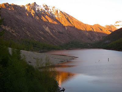
After finishing the Hummocks loop, I drove over to the trailhead at Coldwater Lake. The blast dammed up Coldwater Creek and enlarged a small lake to many times its original size. Now its as big as many US Corps of Engineers reservoirs.
The trail ambles pleasantly along the north side of the lake. Most of the time, I had great views of Minnie Peak. This peak is easily climbed from its northeast side, but looks imposing and impressive from the southwest side. I wonder what it looked like before its trees were blown down.
Of course, lots of views of the lake and surrounding mountains to the west as well.
As is normal for me, I planned to be out hiking during the best light, and I got lots of it! No need for captions on most of these.

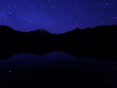
With the exposure controls possible on this camera, I can make as long as a 15 second exposure. And with a top ISO of 3200, that's a good bit of light. This image was made one hour after sunset.

This image was made a little later yet:

After getting back to my car, I drove out a ways, and pointed my camera to where I though I'd see Mt. St. Helens. It was so dark that I couldn't really tell where to aim the camera, except by trial and error. The light on the right side of the image is from the Portland/Vancouver metro area.

Hope you enjoyed!


Glad to see the pix of MSH; I had a graduate student from that area; she had great concerns for the results when MSH blew. Again I've done some reading on that force of nature and the results on the area and the residents therein. Amazing . . . . Herman
ReplyDelete