I own a book, Oregon's Dry Side: Exploring East of the Cascade Crest, that is part travel guide, part photography, and part history and ecology. It's a great companion to a trip to the east side of the state, and was written by a Bend area naturalist, Alan St. John. He describes several hikes in sidebars, most of which I am familiar with from reading more trail-oriented guidebooks. Buried into the text, though, describing the last, most out of the way part of Lake County, is a description of Big Basin. From the description, I knew immediately that I wanted to see the area. He gives a skeletal description of how to walk up into the basin (the route follows a dirt road), but little else. My trip in the Pueblo Mountains last year was following a developed, recreational "route", but not following a physical trail, and this would be the opposite: following a road not intended for anyone but ranchers accessing the land to check on cattle. Compared to the exhausting sage brush bushwhacking of the Pueblos, the road would mean easy walking. The fact that it's not an established recreation corridor would mean I'd likely have it to myself. Given that this was Memorial Day weekend, I thought this would be the loneliest recreational opportunity I could hope for!
I drove here from Summer Lake. Along the way I thought several times about the dangers of driving on country roads. People drive pretty fast, but the roads aren't like the Interstate, so you're meeting other cars head on at 60 miles an hour, with no median. Sobering thoughts. And timely too, as I headed south on the highway, I came upon a crew of men on the road, with a traffic director and police cars. I slowed down and passed the scene of an accident- there was a motorcycle propped up on the side of the road, with a broken windshield and glass all over the road. On the pavement was a body bag. I read about the crash in the newspaper when I got back to Portland. The rider was traveling with other motorcycles when he went off onto the gravel, and lost control. He was one of 5 people to die that weekend in traffic accidents in Oregon.
I couldn't find the road that my guidebook mentioned, so I just parked my car by the side of the highway, and walked across a small alkali flat. This area will fill up with water during really wet times. When I was there, the sand had dried up into a soft concrete, and not many shrubs grow in these areas, so the walking is easy. There are scattered greasewood and sagebrush plants.

When I walk in the middle of the day in such open country, and especially when the ground has such a high reflectivity, I don't just use sunscreen. Instead, I think it's much safer to have a face mask and even gloves, sometimes. The extra clothing is warm, but the temperatures are not so extremely hot as they are in the other American deserts.

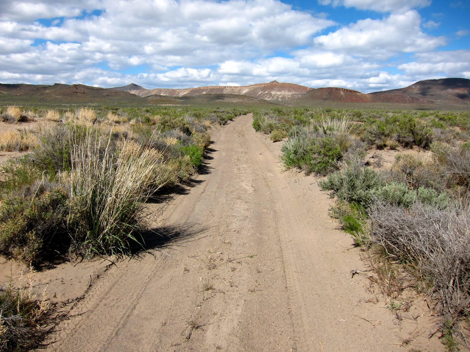
On the other side of the flat, the prevailing winds have pushed up a small set of sand dunes. These ended up being helpful, because by looking for a dip in the dunes, I was able to find the road. In the flat, there is no trace of it. Plenty of tire tracks (people like to go hotdogging over the open ground) but no road. Here's the road heading up into the hills.
Here's a common plant in its natural setting:

I've tried for a while to identify this plant, but haven't been successful. I guess it's a shrub or a flower, but could it be some kind of bunchgrass? I have no clue, and the internet is not much help. As I walked up into the valley, I paralleled a striking ridge with a 20 foot tall rimrock cap on it:

Farther up, I came upon an area of red sand. Make anyone think of Georgia?

And close up:

As I walked up into the valley, the views continued to improve. I started to see the valley from above.

A telephoto shot shows a neighboring drainage, which I think is probably called "Little Basin". In the distance is Abert Rim, the tallest exposed scarp fault in North America.

Drainage might be a little rich, considering that there's not a drop of water even in Big Basin. I carried three liters in for myself for two days, which is basically a bare minimum. I think this might be a place where traveling by ATV makes a lot of sense. Since I can only carry about two half days worth of water, I'm really limited in my range out here. There are another 40 miles of open country to the north of here, along the formation called Diablo Rim. I'd love to check it out, and might be able to make a trip possible by caching water at certain points, or by traveling by mountain bike. Another possibility would be to travel in winter on snow. It'd be frigid, but there'd be water.
I walked up and over the top of the valley on the road, and gained a view down into the next basin to the north.

As the sun got lower and lower, I quickly heated up my dinner. I left it in the pot (no bears here!) and then headed up on to the top of one of the Coglan Buttes to take photos of the sunset.

The light was some of the best I've ever seen, and was energizing! I was so happy to be seeing this kind of natural display of beauty. I had hit upon a view of the side of the butte as my main subject for the great light (like the one above, but actually a little less interesting). While I was fooling around trying to get a great shot of the side of the hill, and then take a self portrait, I was missing what was happening on the flat top of the butte. The sun started hitting the bushes and putting the dirt in shadow while highlighting the round shapes of bunchgrasses and sagebrush. Also, a strong pink light was hitting Abert Rim, 20 miles away. After making way too many shots of the side of the hill, I thought to myself "might as well move on from this" and walked up to the top, where I saw the best photo of the day:

I only got to take one shot of this, as the light faded within about 15 seconds of my discovery. If I'd figured this out a couple of minutes earlier, I'd have an even better photo, as the nice light would have hit more of the plant life. The light on Abert Rim really makes this my favorite. I know there's an element of luck in all of this. But also there's a physical component (bushwhacking up the butte from the road), a planning component (being in the right place at the right time) and also a technical component. Digital film can't replicate the incredible range of light to dark tones that the human eye eats for breakfast (or even the range that color film can capture). So an autoexposed image of this would have been correctly exposed either for the foreground or the background (because the background is so much lighter). I've recently bought a filter that is clear on the bottom and dark on the top, which allows one to expose for both light and dark on the same photo. Before last week, I'd never used it, and this night, it made this photograph possible.
I turned the camera around to try to capture the color of the clouds at the setting sun:

Finally, after the light show ended (around 8:30) I headed back down, ate dinner, and set up camp. Sunrise was at 5:20, and I planned to be there!

The obligatory photo of my feet.
More on the way.
C
Glad you got your feet in the last shot. On this hike I was glad you shared some comments on the difficulties you endure (water, camp sites, places 'like' concrete, sand). Your careful planning of the hikes leaves a positive impression with me. And I'm always glad to see you in some of the pictures; comments about face masks and/or sunscreens impressed me. Herman
ReplyDeleteGorgeous photography. I'm completely inspired by your blog as I'm researching my next Oregon adventure (getting a little antsy this winter). :)
ReplyDelete