After walking up Warner Peak in the evening, I got back to my car at about 11pm. I pulled out of the trailhead parking lot and found an empty site in the nearby campground. Just as I got tucked into my back seat for a night of deep recovery sleep, a nice light rain started up. It was a great night to be inside, even if the inside was the cramped rear seat of a Honda Civic. Actually, the several nights I've spent in the car in bad weather are all fond memories. I can see why people travel in campers. That would certainly be more comfortable. Here's the campsite the next morning.

After getting up this morning I actually soaked in the hot springs. I've never soaked in hot springs before, and it was pleasant. A little weird to be sitting out in the open, in 100 degree water while its 50 degrees, with a light rain. Getting out was cold! I drove back to the Refuge headquarters for one last time, to fill out my last night's backpacking permit. On the way, the cloud cover continued:

I drove back down the steep road to Warner Valley, then down the valley a ways to the head of DeGarmo Canyon. I had walked up the pass from the Rock Creek drainage to the headwaters of DeGarmo Creek the day before, and today I would walk up DeGarmo Creek itself, and camp up in the Canyon. As I packed up my backpack, I took in views of the Warner Mountains across the valley:

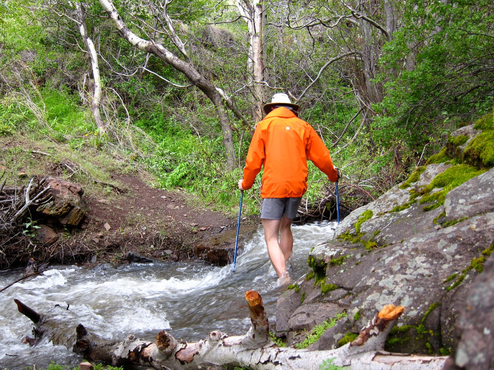
I followed my guidebook's route up the canyon, which was a faint boot path, and involved a good bit of scrambling. It began with a small ford of the creek:

I followed my route up to the fall:

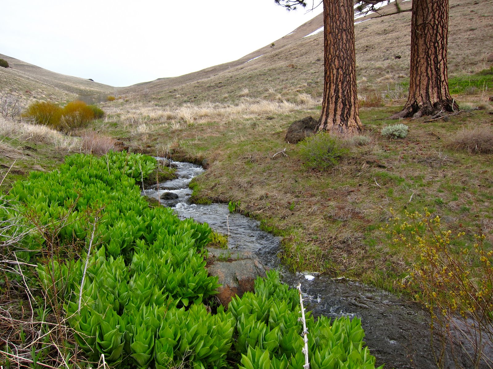
I scrambled up the canyon side to find an old cattle drive trail, which provided more pleasant walking for a way up the canyon. As is typical for these Great Basin mountain ranges, the farther up I walked, the more trees I found, and the larger they became, until a certain point, when they started shrinking. The vegetation patterns are determined by a fascinating and complex interplay of factors including sunlight, temperature, snow and rain fall, and soil content and depth. Aspect (which direction the mountain slopes face) affects the amount of sunlight and precipitation. Soil depth and content is affected, of course, by the amount of plants growing on the soil- in the Cascades there's sometimes a foot of loam on top of rock. Here the best soils are washed down into the lowlands during spring runoff. In this canyon, the microclimate of the mid elevation supports a varied forest of ponderosa pines and juniper, with cottonwoods and huge aspen groves in the riparian areas (next to the creeks). Below this elevation, it's too dry to support ponderosa pines, and above, it's too cold or possibly too windy (I'm not sure).

I always forget how frustrating it is to try and photograph a canyon- the best light never makes it down below the walls of the canyon. Here's some nice light on the higher country:

I managed to find a flat spot for my tarp under both a ponderosa and a juniper tree, growing together. When I got up the next morning, it was raining. Felt like a good morning to sleep in!

When I got up I walked up hill into more open country, with scattered ponderosa and juniper:

Above this, there are only a grove of aspen trees at the pass. On my way up I spotted a baby pronghorn. It allowed me to take a couple of photos, and then ran away:

I returned to the mouth of the canyon via the cattle drive trail. Nice views of the west escarpment of Hart Mtn.:

Happy camper!

The worst part of this day's travel was the road back down to the Refuge's access road. This photo doesn't do justice to the road's true awfulness:

Next up, Fossil Lake Sand Dunes!
I'm signing in as 'anonymous' but I'm really Herman . . . . you did look like a happy camper . . . I'm glad you showed picture indicating the difficulty you have walking in some places . . . here I sit in the comfort of my apartment, taking in the beauty of your hiking/climber . . . whichever word is appropriate.
ReplyDeleteI loved your photos and adventure stories. :) Thanks for sharing!
ReplyDelete